
Winter weather will have an impact on the entire state of Michigan this week, but it'll differ depending on where you live.
Most of the state is under a Winter Storm Watch starting early Tuesday morning and into Wednesday. Here's what to expect across the state:
Recommended Videos
Metro Detroit
We are all under a winter weather advisory starting at 1 a.m. Tuesday and going all the way through Wednesday morning. The threat is for dangerous conditions from freezing rain and sleet to accumulating snow.
Starting early Tuesday, we will have snow and sleet switching to freezing rain, especially south of M-59. Areas north of M-59 should get a little more snow than freezing rain and snow totals could add up and mix with some sleet and freezing rain.
Track the latest school closings here
Most of Metro Detroit will have more freezing rain taking hold and some areas could get a quarter of an inch of ice or more early tomorrow. The wet weather will come and go all day with temps climbing to near 40 degrees, many of us will see a switch to rain which will melt the ice quickly.
Many areas north of M 59 and I-69 will keep seeing snow adding up and could see upwards of 6 inches of snow and very dangerous travel from ice, snow, and blowing snow as the winds pick up too SE/SW 7-17 mph gusting to 25 mph.
More: Winter storm watch in Metro Detroit tonight: What you need to know
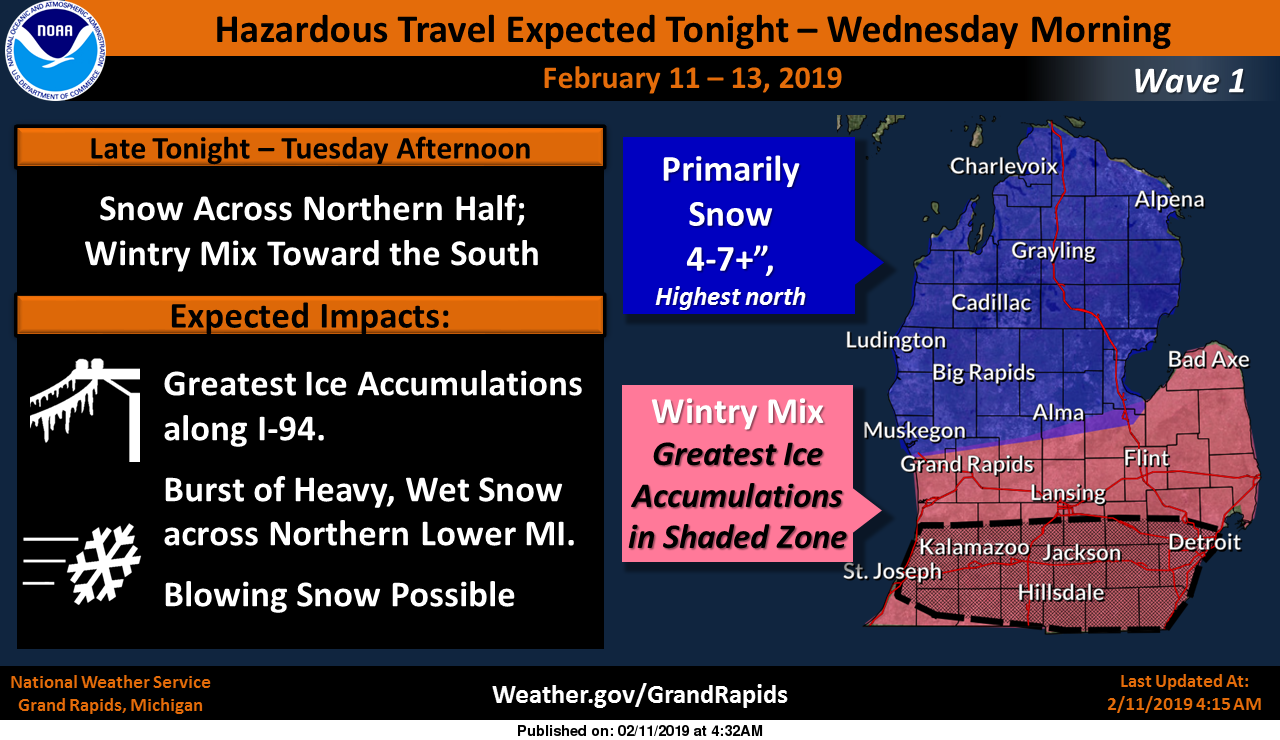
West Michigan
The first round of wintry weather will start after midnight tonight and last through Tuesday afternoon. A wintry mix is expected across the southern half of Lower Michigan with ice accumulations possible along I-94. Snow is expected across the north with 4-7" (locally high) possible. Areas of blowing snow are also possible with winds out of the east gusting to 30 mph.
The second round of wintry weather will start Tuesday evening and last into early Wednesday morning. All snow is expected, with strong wind gusts in excess of 40 mph leading to areas of blowing snow and at times zero visibility. Downed tree limbs and power outages are possible along I-94 where ice accumulated earlier in the day. The heaviest snow totals are expected along the Lake Michigan shore line and along I-94.
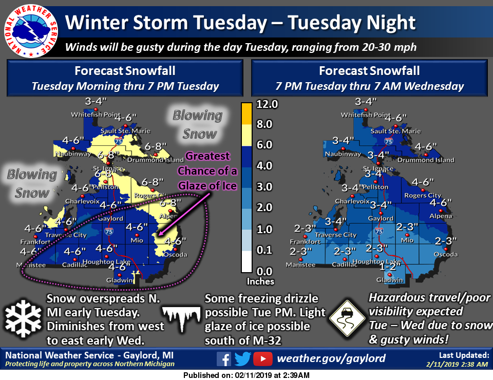
Northern Lower Michigan
A winter storm will move through the region early Tuesday through Tuesday night, bringing significant snowfall to much of northern Michigan. Gusty winds leading to blowing/drifting snow and some light freezing drizzle also expected. Hazardous travel expected during this time frame!
Upper Peninsula
Other than a few flurries, weak high pressure moving over the region will result in mostly dry conditions and seasonal temperatures today.
A deepening storm system lifting up from the Central Plains will then bring widespread heavy snow and areas of blowing snow into Upper Michigan Tuesday with snow gradually tapering off from the south Tuesday night.