
DETROIT – Things are very quiet on 4 Live Radar as of the time I am writing this article (1:45 PM).
A warm front crossed the area this morning, with some isolated showers, but those are gone and partial sunshine has filtered into the area.
Recommended Videos
All's quiet right now in our area, but scattered storms are erupting ahead of the cold front. Need to monitor... pic.twitter.com/r1pdifWUPD
— WDIV Local4Casters (@Local4Casters) May 12, 2016
Update: storms running a little behind schedule. If you have our weather app, this is great to watch on the radar. pic.twitter.com/39r75qef6e
— WDIV Local4Casters (@Local4Casters) May 12, 2016
Storms beginning to move into our area -- nothing severe yet. Stay alert. pic.twitter.com/XhrSRvtkWd
— WDIV Local4Casters (@Local4Casters) May 12, 2016
So far, so good: solid downpours with lightning and thunder, but no severe weather. pic.twitter.com/mWfsHgWGFg
— WDIV Local4Casters (@Local4Casters) May 12, 2016
While the sunshine and warmer temperatures are certainly welcomed by many of you, any extra heat and humidity we get this afternoon just increases the potential for some strong or severe storms. There are definitely pluses and minuses for severe weather this afternoon.
SPECIAL SECTION: Severe Weather Safety Tips
While it looks as if we’ll be unstable enough here at the surface for an approaching cold front (a big plus) to trigger some storms, the instability aloft doesn’t impress me as much as the models were advertising yesterday (a minus). The warmer it gets this afternoon, the more unstable the lower atmosphere will get, which enhances the chance that the front can generate some storms (a plus).
As I’ve explained during the week, another key ingredient for severe storms is wind shear, which is simply a change in the speed and direction of the wind as you go up from the surface. While we have good directional wind shear this afternoon (a plus), the wind speeds aloft don’t look all that strong (another minus). This makes it less likely that a storm will be able to drag down super strong wind to the surface.
What does this mean for you?
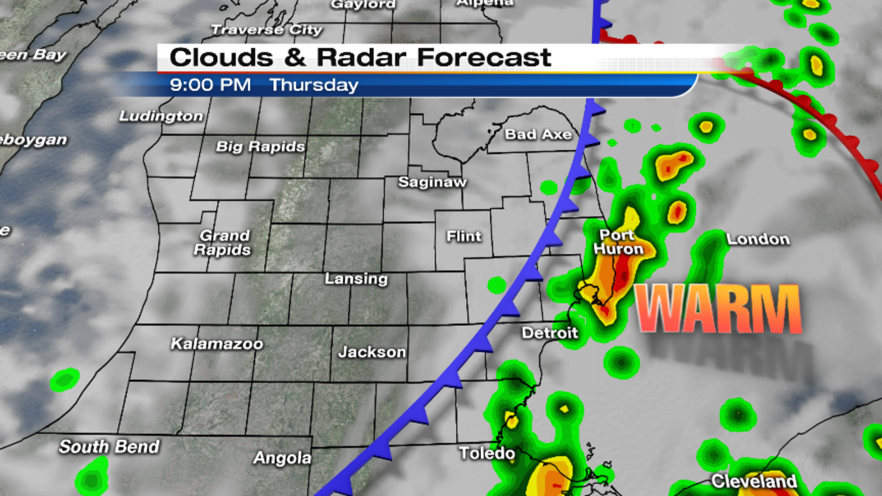
My take on things is that the approaching front will trigger scattered storms -- probably not until after 3 p.m. to 4 p.m. for our western suburbs, and then moving eastward from there.
Two things to notice on the maps below are the scattered nature of the storms, and how the coverage expands late in the event to the east.

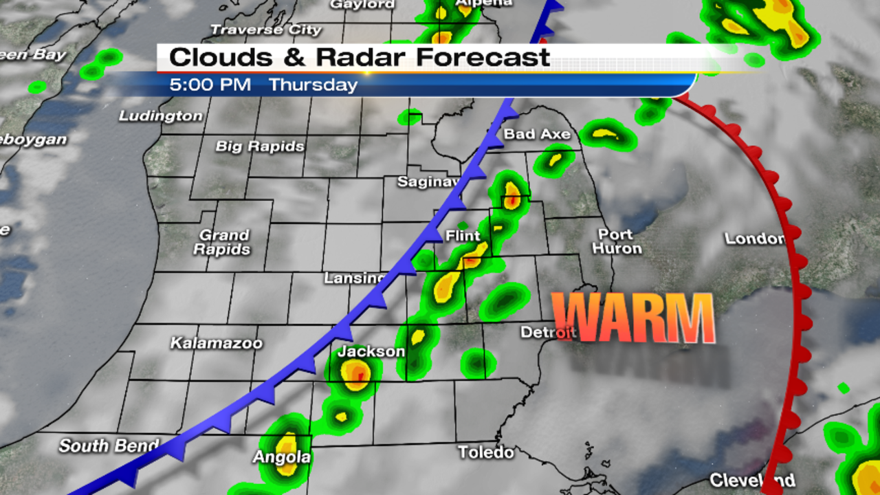

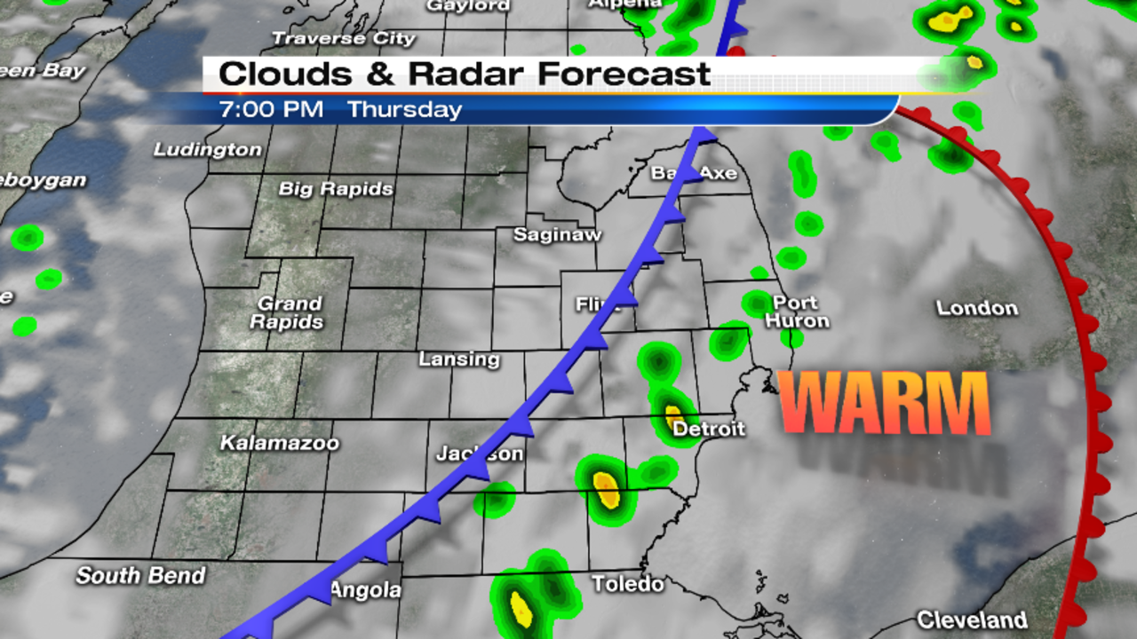
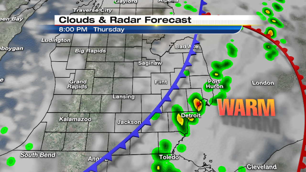
If any storms become severe, I don’t think it’ll be widespread -- many more people likely won’t see severe weather than will. Any severe storms that do develop probably would have brief 60 mph wind gusts, and perhaps nickel to quarter-size hail. Of course, just because a storm isn’t severe doesn’t mean it’s not dangerous. Keep in mind that sub-severe wind gusts can still bring down tree limbs. And lightning is always a big danger for anybody outside -- don’t take this lightly, since there will be a lot of after school sporting events and practices going on this afternoon and evening.
Showers and storms should be out of the area by 9 p.m. or so.
Ben Bailey will have the latest
Ben will be live starting on Local 4 News First at 4, and then on Local 4 News at 5 and 6…all of which you can watch live here on ClickOnDetroit.com if you’re at work. It’s a great way to stay connected with us if you’re away from your TV.
Stay informed with Local 4Casters app
I also strongly urge you to download the free Local 4Casters weather app -- just search for WDIV in the app store.
One of the app’s best features is that we designed it with you in mind: Radar is the most important thing that people want to see, so when you open the app, it opens right to the radar page. And you can zoom in and out and pan the map with your fingers.
The storm track layer gives you particular storm specific information on top of the radar -- just tap any storm dot and up pops the info.
Also don’t forget to follow me on Twitter at @PGLocal4 and @Local4casters, as I’ll tweet personalized updates through the afternoon.
Upload weather pictures to StormPins
Finally, if you see a strong or severe storm, or some damage after the fact, and can SAFELY do so, shoot some video or photos and post them on Storm Pins (you get that app free in the same place you get the weather app). Not only can we get those on the air quickly, and not only can you see all of the other photos and videos being posted, but you also help out the National Weather Service, they monitor your reports on Storm Pins.
Stay safe.
SPECIAL SECTION: Severe Weather Safety Tips