
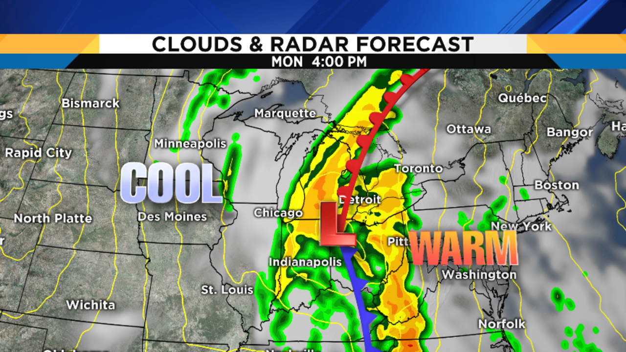
Rain arrived right on schedule late this morning into the afternoon, and there’s more where this is coming from.
WATCH: Live Radar
Recommended Videos
Periods of rain will continue through the night, with lows in the low 50s (10-11 degrees Celsius). It’ll also be a windy night, with southwest winds of 15 to 25 mph, and even some higher gusts than that.
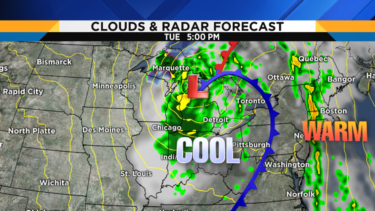
Periodic rain continues on Tuesday, although there will also be some parts of the day where it’s not necessarily raining over you. But plan on rain and keep the umbrella handy. Temperatures may rise slightly into the low to mid 50s (11-12 degrees Celsius) by early afternoon, and then start falling by mid-to-late afternoon. Southwest wind at 15 to 25 mph will gusts over 30 mph at times.
Tuesday’s sunrise is at 7:57 a.m., and Tuesday’s sunset is at 6:37 p.m. Reminder: we go off Daylight Saving Time and return to Eastern Standard Time at 2:00 a.m. on Sunday, November 5th. So, make a note that you need to set your clocks BACK an hour before you go to bed Saturday night, November 4th. Enjoy that extra hour of sleep!
Light rain showers continue Tuesday night, with lows near 40 (4-5 degrees Celsius).


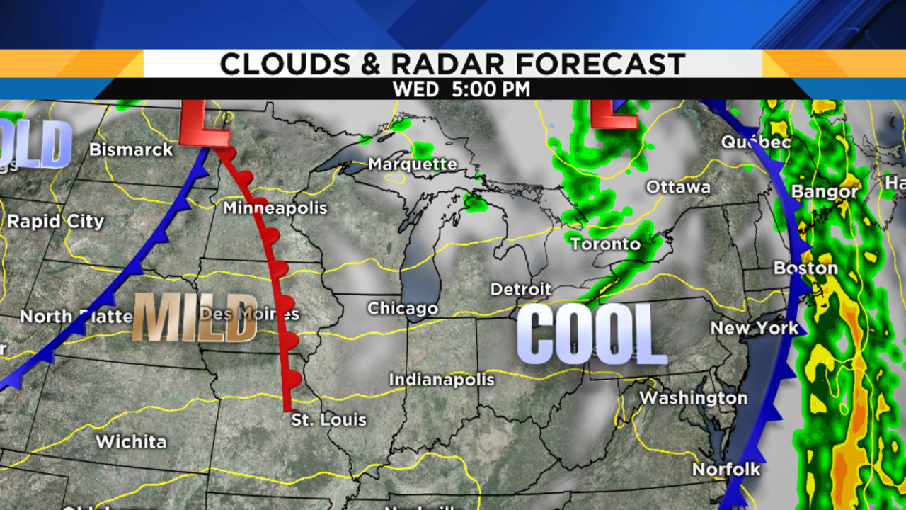


Any lingering showers Wednesday morning should end, leaving us dry for the afternoon. It’ll be a brisk day, though, with highs only in the upper 40s (9 degrees Celsius).
Partly cloudy Wednesday night, with lows in the upper 30s (4 degrees Celsius).
Partly cloudy and becoming breezy on Thursday. We get a nice little warm-up, though, with highs near 60 degrees (15-16 degrees Celsius). But don’t get used to it…
Partly cloudy Thursday night, with lows in the mid 40s (7-8 degrees Celsius).
Partly to mostly cloudy on Friday, with a small shower chance late in the day. Highs in the mid 50s (13 degrees Celsius).
Showers are possible Friday night, as a potent cold front crosses the area. Lows in the mid to upper 30s (3-4 degrees Celsius).
Mostly cloudy both Saturday and Sunday, with some showers possible on Saturday depending upon how quickly the cold front moves through. Highs both days in the upper 40s. Of greater interest is Saturday night and Sunday night: IF skies clear out (and they might not), and IF the wind becomes calm (and it might not), then we would have some frost possibilities. This is still a long ways off, but the Local4Casters are monitoring this closely and will keep you updated on Local 4, as well as on ClickOnDetroit.com. By the way, there’s also a chance of flurries on Sunday, but I won’t go there just yet…
Partly cloudy on Monday, with highs in the low 50s (11 degrees Celsius).
Halloween Forecast:
Right now, Halloween looks dry for the kids’ school parades and outdoor parties, with highs in the mid 50s (13 degrees Celsius). As for Trick or Treating time itself, that looks dry as well, with temperatures falling into the 40s (8-9 degrees Celsius) Tuesday evening. That would be considered “average” Halloween weather, which we’ll take. Obviously, we’re still eight days away, so this could change…the Local4Casters will keep you posted. Save me some candy corn!

