As expected, what a crazy day it was Tuesday. After spending the majority of the day with relatively average February temperatures, abnormally warm air surged into the area late in the afternoon into the early evening hours. Those of you from M-59 southward made it into the 50s (10 to 14 degrees Celsius), but even north of M-59 you at least made it into the mid to upper 40s (6 to 9 degrees Celsius). Officially at Metro Airport, yesterday’s high of 56 degrees (13.5 degrees Celsius), broke the old record of 53 degrees (11.5 degrees Celsius), set in 1882.
And then there was the rain. Most of our area received between 0.50” and 1.0”, with a few locations reporting over one inch. Officially at Metro Airport, yesterday’s 1.01” of rain fell just shy of the February 7th daily rainfall record of 1.04”, set in 1887.
Recommended Videos
Finally, a potent cold front crossed the area early-to-mid evening, with sharply falling temperatures behind it. You could have gone outside at 7:00 p.m. and experienced some spring, and three hours later experienced wind and wind chill!
Cold air remains overhead, and even colder air is on the way for Thursday. Tonight will feature cloudy skies, with a few snow showers possible. Lows in the mid to upper teens (-9 to -8 degrees Celsius). North-northwest wind will shift to the west later tonight, and blow at an average 8 to 13 mph.
Mostly cloudy with scattered snow showers to start our Thursday, before clouds start to break up for the afternoon. Highs only in the low to mid 20s (-5 degrees Celsius), but a brisk west wind at 15 to 20 mph will keep wind chills around 5 degrees (-15 degrees Celsius). Bundle up…it’ll be a cold one! Thursday’s sunrise is at 7:37 a.m., and Thursday’s sunset is at 5:58 p.m.
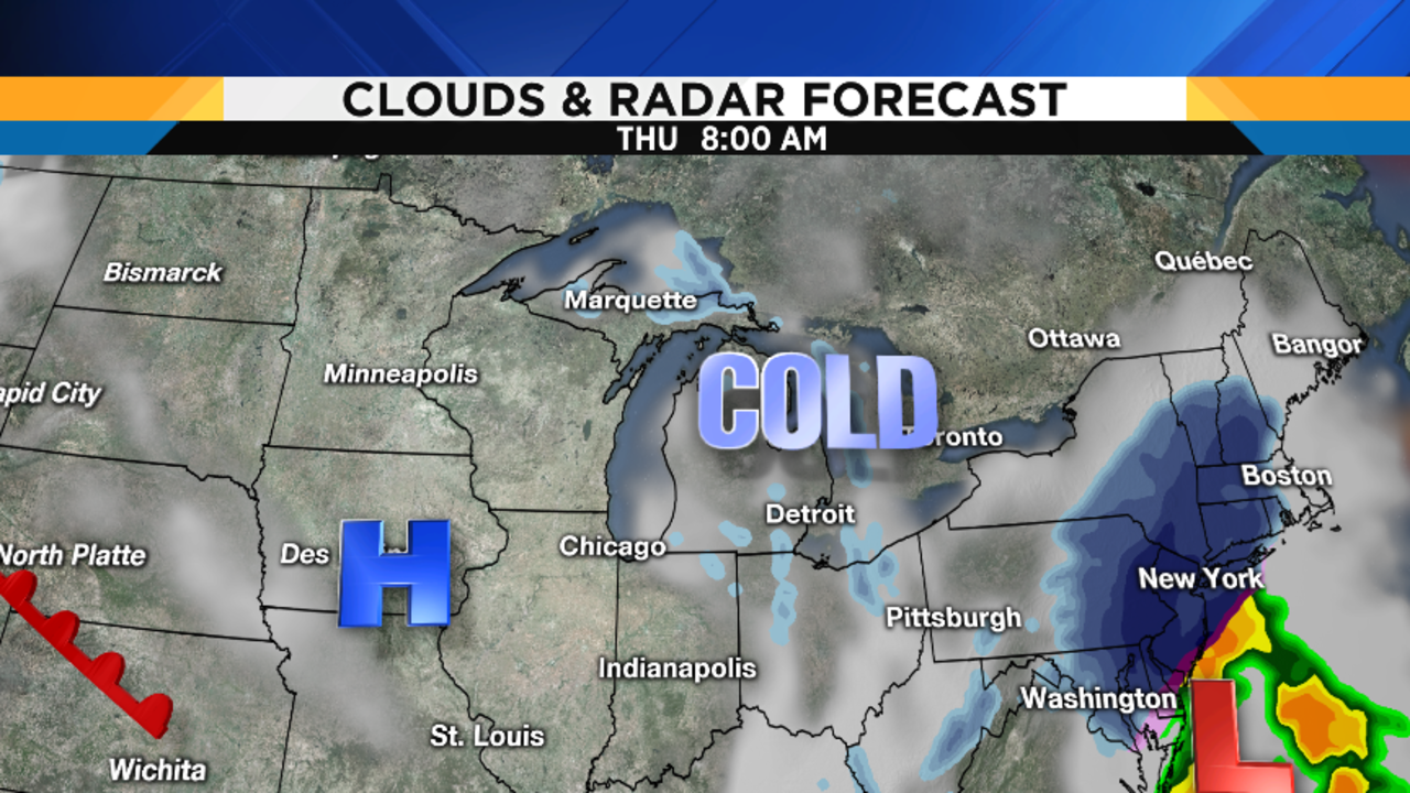
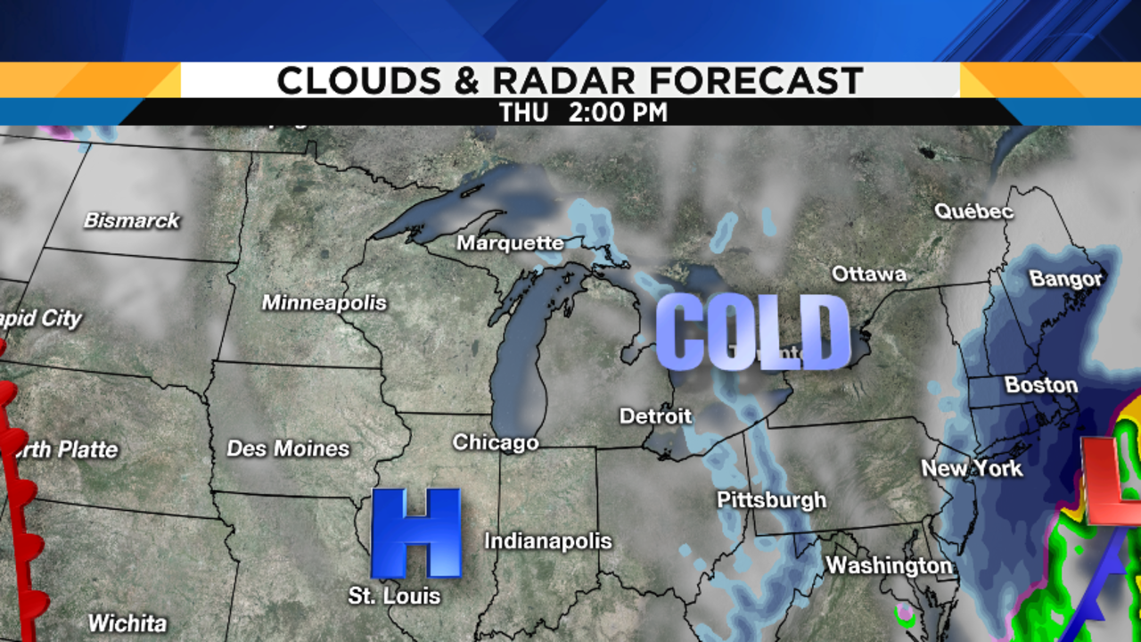
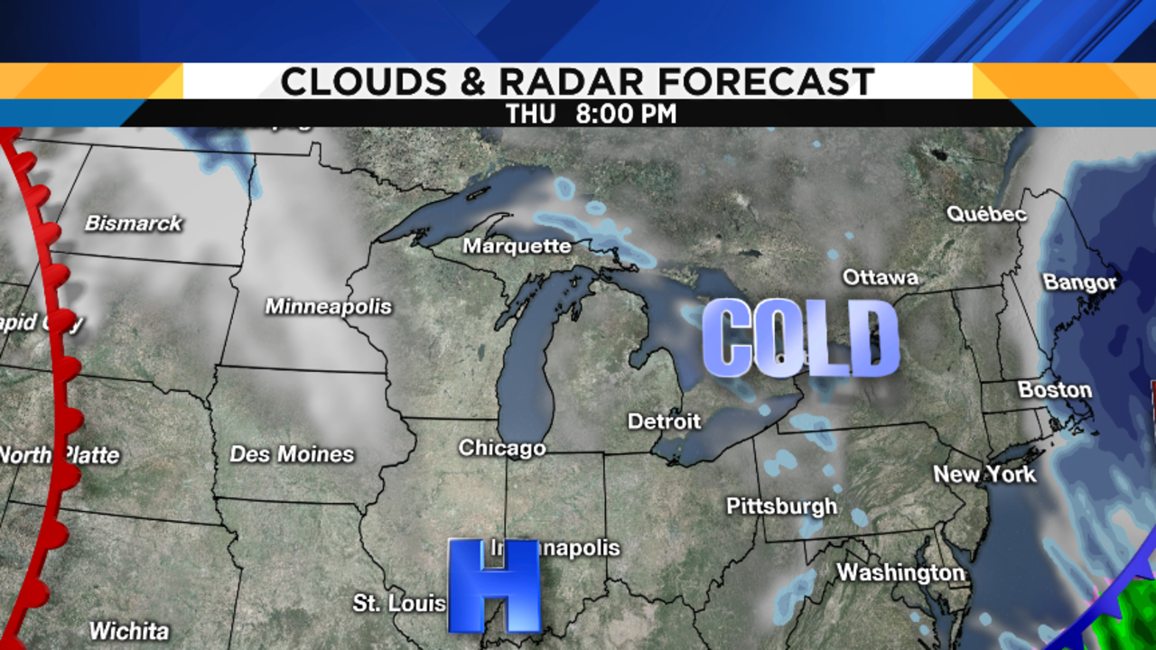
Travel note: As you can see on the maps below, a rapidly strengthening storm will create some travel trouble in the northeast on Thursday. At daybreak, heavy snow will be moving into major airport hubs like Philadelphia, Newark, and New York. By midday, Boston will be impacted. If you have travel plans out east on Thursday, be aware of this, and remember that you can check the radar ANYWHERE in the nation on our free Local4Casters app…just search in the app store under “WDIV.”
Partly cloudy Thursday night, with lows in the low teens (-11 degrees Celsius).
Cloudy on Friday, with a few flurries as a warm front approaches (those of you in our North Zone could see a bit more than flurries, but I do not expect any significantly impactful snow). Highs rebounding back to near 30 degrees (-1 degree Celsius).
Mostly cloudy Friday night, with near-steady temperatures in the upper 20s to near 30 degrees (-2 to -1 degree Celsius).
Cloudy on Saturday, with some light rain possible by mid to late afternoon. I think the first half to two-thirds of the day will be dry, so take advantage of that if you have some outdoor plans. Highs in the mid 40s (8 degrees Celsius).
Rain chances continue Saturday night…possibly mixed with some wet snow. Lows in the low to mid 30s (0 to 2 degrees Celsius).
Rain is likely on Sunday, with highs in the mid 40s 97 degrees Celsius).
Partly cloudy on Monday, with highs in the mid to upper 30s (3 degrees Celsius).