Auto Show opening weekend is finally upon us, and you really couldn’t ask for better weather (well, you can always ask, but it won’t get you anywhere – I can’t do anything about it). The weather will not be an excuse for not heading down to Cobo Center and, even after this weekend’s return to “average” winter temperatures, we’ll warm right back up next week. And, yes, 50 degrees (10 degrees Celsius) is back in the forecast!
But first, I want to make it clear that the historic ice storm that will hit the central part of the nation over the weekend will NOT affect us. Through this past week, several people have either tweeted me or come up to me in a store asking about our big ice storm this weekend. I never once even hinted that this was even a possibility. You’ve heard in the news lately a lot of reporting about “fake news.” Well, there is also a lot of “fake weather news” out there, too (my colleagues around the nation and I have actually been discussing this for quite a while). There are a lot of weather enthusiasts who are not meteorologists who think they are really cool by sensationalizing the weather and trying to tell you about a big storm ten days ahead of time (which no credible meteorologist will EVER do). There are also some apps that are totally automated with forecasts based only upon computer model data, and no human element whatsoever (and we all know that the models by themselves are sometimes wrong). And there are also some weather companies who sensationalize the weather to get you to click on their websites. Please understand that we will always tell you if there is ANY chance for a disruptive weather event on the horizon, and will do so if there is enough credible evidence suggesting that we should raise the issue. Neither I, nor any of the Local4Casters, withhold information because we’re afraid that YOU’RE afraid of what we might say. We’ve earned your trust over the years, and will not violate that trust. Please don’t buy into any of that sensationalized weather fake news and, more importantly, please don’t share it.
Recommended Videos
Alright, about that central plains storm: check out this output from our in-house RPM computer model, and focus on the Kansas / Oklahoma area.
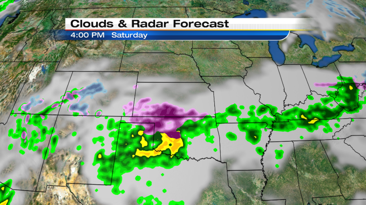
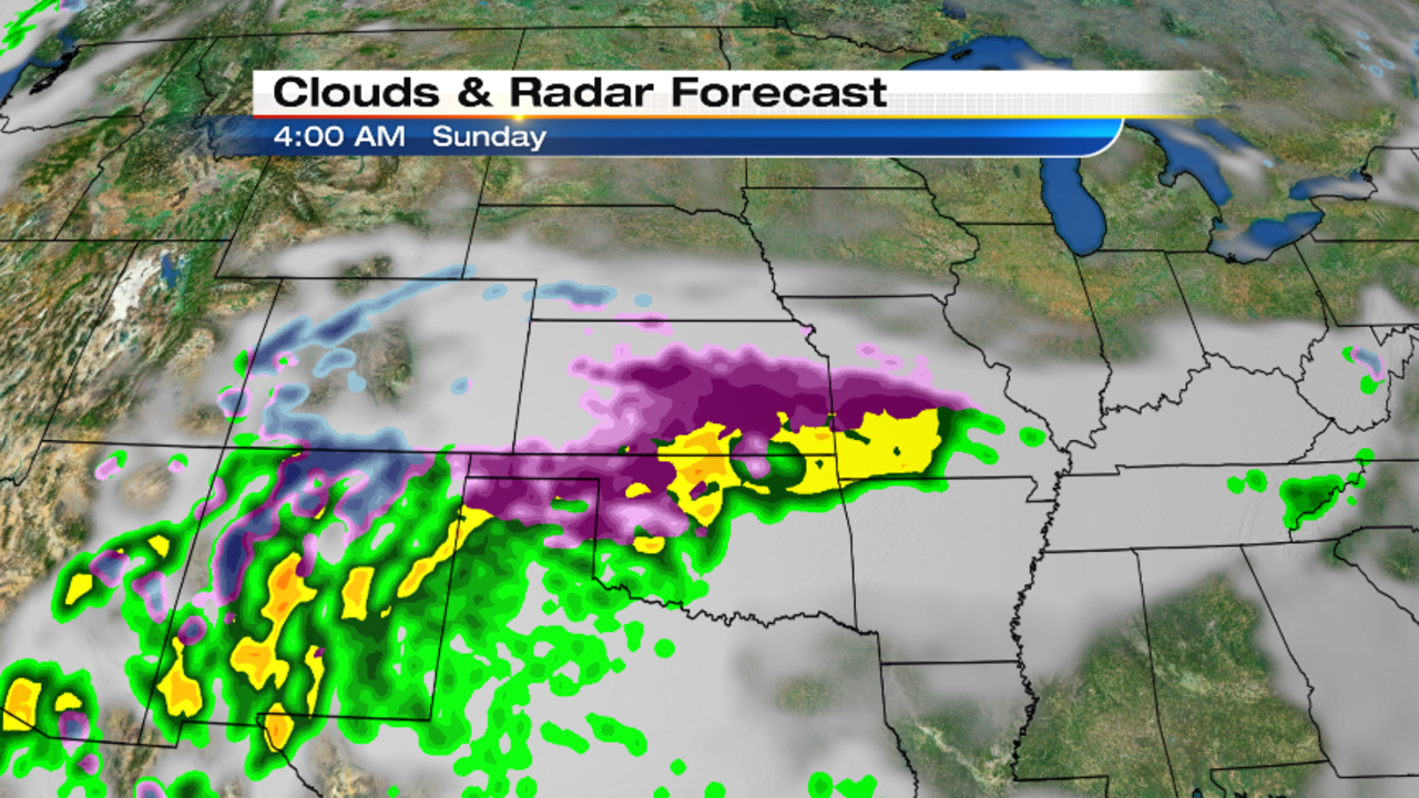
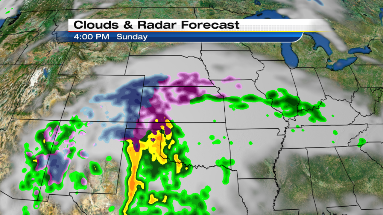
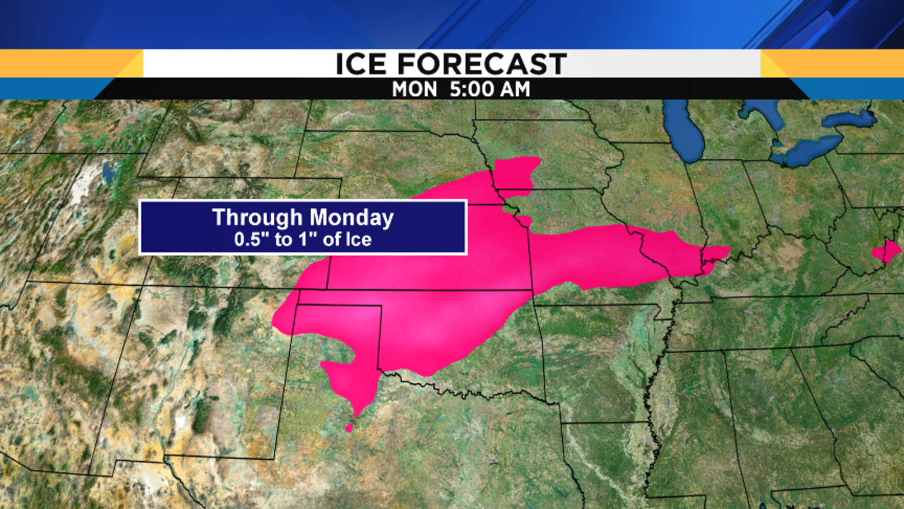
The purple color is freezing rain, and notice how that ice will accumulate for hours and hours. This is going to be an historic ice storm, with ice accumulations in the hardest hit areas approaching one inch. That’s incredible, and let me put it in perspective for you: around here, we consider a severe ice storm to be a 0.25 to 0.50” ice accumulation. They’ll be getting twice the amount of what we call a severe icing event.
The icing potential is so severe that the NFL has just decided to move the AFC divisional playoff game between the Pittsburgh Steelers and the Kansas City Chief (at Arrowhead Stadium in Kansas City) from 1:00 PM Sunday to 8:20 PM Sunday. Since that game is on NBC, this now becomes a bonus Sunday Night Football game. It’ll be REALLY interesting to see how the field conditions are at game time. Remember that they can sweep and shovel snow off the field. I’m not sure what they can do about ice!
Again, in contrast to what some of you might have heard from untrustworthy sources, this storm will NOT have any dramatic impact on us.
Here’s your local forecast:
Expect mostly cloudy skies overnight, with lows in the upper teens (-8 degrees Celsius). Light and variable wind.
Even if we begin our Saturday with clouds, I think we’ll see a degradation of those clouds through the day, giving us at least some afternoon sunshine. Highs in the low 30s (0 degrees Celsius) combined with a light and variable wind means it’ll be a great winter day! I just wish we had some snow on the ground for the kids to play in. The ski resorts all have snow on their slopes…they make all they need and more…but there’s nothing in our front or backyards for the kids.
Saturday’s sunrise is at 8:00 AM, and Saturday’s sunset is at 5:26 PM.
Partly cloudy Saturday night, with lows in the upper teens (-8 degrees Celsius).
Mostly sunny on Sunday…another fantastic winter day…with highs in the low 30s (0 degrees Celsius).
Increasing clouds later Sunday night, with lows in the low 20s (-5 degrees Celsius).
If you’ve been following my forecast all week long, you may recall my discussing a possible wintry mix developing on Monday, and then changing to rain. Today’s models slow the arrival of the approaching moisture, and this delay in the associated precipitation’s arrival now means that it’ll arrive at a warmer part of the day. As a result, I don’t think we’ll see any (or much) frozen precipitation at the onset. In fact, the first half (or more) of our Martin Luther King, Jr. holiday could end up dry! Highs in the mid 30s (2 degrees Celsius) aren’t too hard to take…
Rain showers are likely Monday night, with steady temperatures in the mid to upper 30s (2 to 3 degrees Celsius).
Rain is likely on Tuesday, with temperatures rocketing into the upper 40s (9 degrees Celsius)!
Rain showers diminish Tuesday night, with lows in the upper 30s (3 degrees Celsius).
Mostly cloudy on Wednesday, with highs in the mid 40s (6 to 7 degrees Celsius).
Partly cloudy on Thursday, with highs in the mid 40s (8 degrees Celsius).
Mostly cloudy on Friday (small chance for a shower), with highs near 50 degrees (10 degrees Celsius)!
While this could change, next weekend appears warm with rain showers. Highs Saturday could once again be near 50 degrees (10 degrees Celsius), and highs Sunday in the id 40s 7 degrees Celsius).