
It’s been quite a ride, temperature-wise, this week, and you know it can’t last forever…winter will return. And that transition from spring-like weather to winter-like weather is sometimes quite nasty, which is something I need to monitor later this week. I’ll delve into that in great detail in just a moment, but let’s start with tonight.
The mild air mass over us will remain here overnight. An approaching weak cold front could trigger a late-night sprinkle or brief light shower, but I think many more of us will stay dry than get wet. Lows in the low to mid 50s (11 to 12 degrees Celsius) will obliterate Thursday’s record for warmest low temperature…IF the temperature doesn’t drop below 47 degrees (8.5 degrees Celsius) before midnight Thursday night. South wind at 8 to 12 mph.
Recommended Videos
Mostly cloudy to start on Thursday, then we’ll probably see a midday period of partly cloudy skies before clouds roll back in by mid to late afternoon. Highs in the low 60s (16 degrees Celsius) should be just shy of Thursday’s record high of 64 degrees (18 degrees Celsius), set in 1984. South wind at 5 to 10 mph early in the day will shift to the north once the cold front passes by, which will limit our afternoon temperature rise.
Thursday’s sunrise is at 7:18 a.m., and Thursday’s sunset is at 6:16 p.m.
Mostly cloudy Thursday night, with rain and possibly some thunderstorms developing well after midnight. These storms will NOT be severe. Lows in the low 40s (5 degrees Celsius).
Here is a series of maps showing you the weather’s progress on Friday, which I will explain below:


The Thursday night rain and thunderstorms should end by mid-to-late morning Friday as a warm front advances northward across the area. It’s a little unclear how far north the front will go but, right now, I expect it to at least reach the I-69 corridor. Those of us who get south of that warm front (eventually, most of us) should see the clouds thin, allowing some midday hazy sunshine. Remember that a warm front is the front edge of warmer air, so it’s back to record high territory, with highs reaching the mid to upper 60s (20 degrees Celsius), which will destroy our old record of 60 degrees (15.5 degrees Celsius), set back in 1871. Note: the National Weather Service used to recognize this record high as one of our oldest standing records but, when they moved offices from Metro Airport to White Lake in the mid 90s, the original books with the recorded data from 1870 to 1873 somehow got lost, so this record was one of several that was decertified. However, I still personally recognize those record highs, lows, precip and snow from 1870 to 1873 – I have those recorded in my own database – and I intend to go to the Burton Collection at the Detroit Public Library someday when I have some time and research the old newspapers, looking for the daily weather report from the old Weather Bureau and verify a bunch of these oldies but goodies, and formally request that the National Weather Service recertify them.
Friday night is the main event for this week, as a strong cold front will generate a line of showers and thunderstorms that could potentially become severe. Remember that we’re more than two days from this event, so some of the smaller scale details are still a bit up in the air (no pun intended). However, there are some things becoming apparent that have me concerned about some damaging wind gusts with these storms:

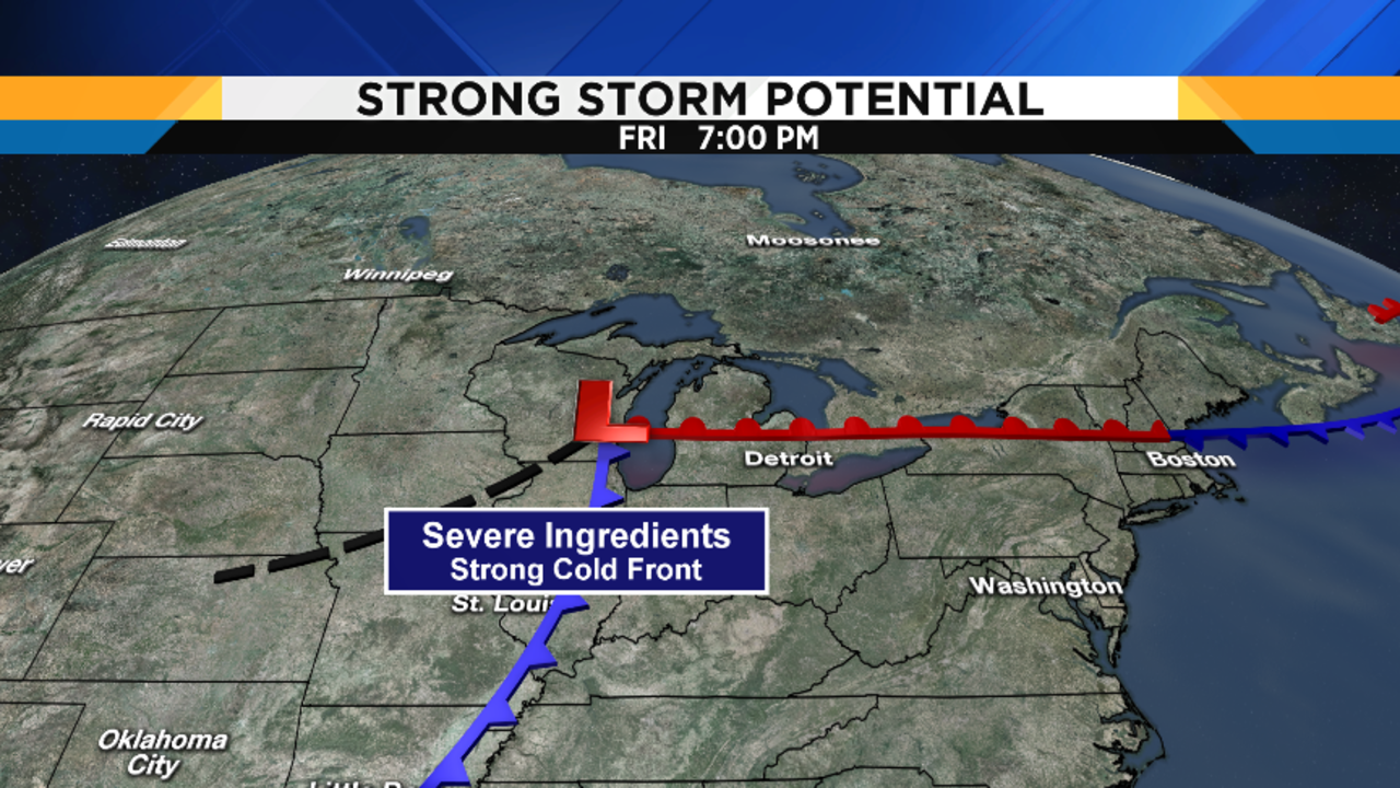

First of all, The unusually warm, humid air mass (by February standards) will make things unstable enough to generate thunderstorms. Second, the strong cold front will be a substantial trigger to initiate convection (rapidly rising parcels of air upward), which will maintain that line of storms. Third, a band of strong wind aloft will approach from the southwest. Not only will this provide strong wind that the storms can translate to strong surface wind gusts, but it will also cause a lot of wind shear (change in wind speed and direction as you go up from the surface). These are all positives for strong to severe thunderstorm development. However, there is a big negative: the line of storms won’t approach until after 10:00 p.m. Friday night, so they won’t arrive at the warmest part of the day. I’m pretty confident that we’ll get a line of storms coming through, and reasonably confident that strong-to-severe wind gusts will accompany these storms. However, it’s how widespread this threat is that I’m uncertain about. Generally, though, the farther south you are, the farther into the warm, unstable air mass you’ll be and, thus, the better the chance you’ll see severe storms. Take a look at the Storm Prediction Center’s severe risk map above at the top of this article, and you’ll see what I mean.
Once the cold front blows through, any remaining showers and thunderstorms early Saturday morning will end pretty quickly. A dry slot behind the front will probably give us partly cloudy skies for a while, before we cloud up again and snow showers arrive for the late afternoon / evening period. It’s going to be quite windy on Saturday, and temperatures will fall through the day…we’ll probably be in the mid 30s (3 degrees Celsius) by the end of the afternoon.
Snow showers gradually taper off overnight Saturday night, with lows in the upper 20s (-2 degrees Celsius).
Sunday will be partly cloudy and still breezy, with highs in the upper 30s (4 degrees Celsius).