Everything appears on track, forecast-wise, except for a small change to the Friday night forecast. But overall, today’s computer models are showing robust agreement in the handling of things over the next week.
Tonight will bring clearing skies, although some high clouds may stream back in late at night. Lows in the low 20s (-5 to -6 degrees Celsius). Southwest wind at 4 to 8 mph.
Recommended Videos
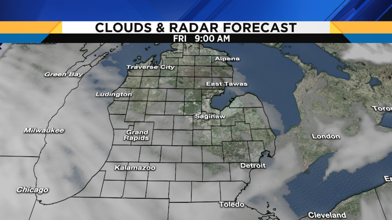
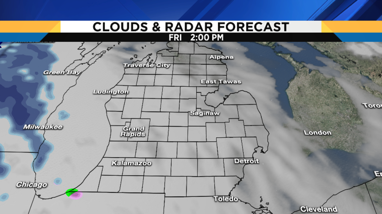
After at least partial sunshine to start on Friday, clouds will increase during the day. Highs in the mid to upper 30s (2 to 3 degrees Celsius). South wind at 7 to 12 mph. Friday’s sunrise is at 8:00 AM, and Friday’s sunset is at 5:06 PM. I hope you have a wonderful Festivus…don’t forget your aluminum pole, and good luck with airing your grievances, and with your feats of strength! If you still don’t know what Festivus is, you’ll have to Google it and watch that episode of Seinfeld – it’s hysterical.
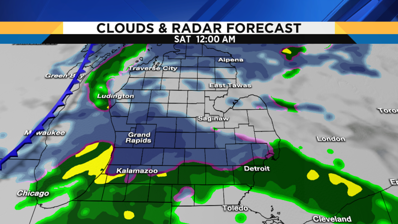
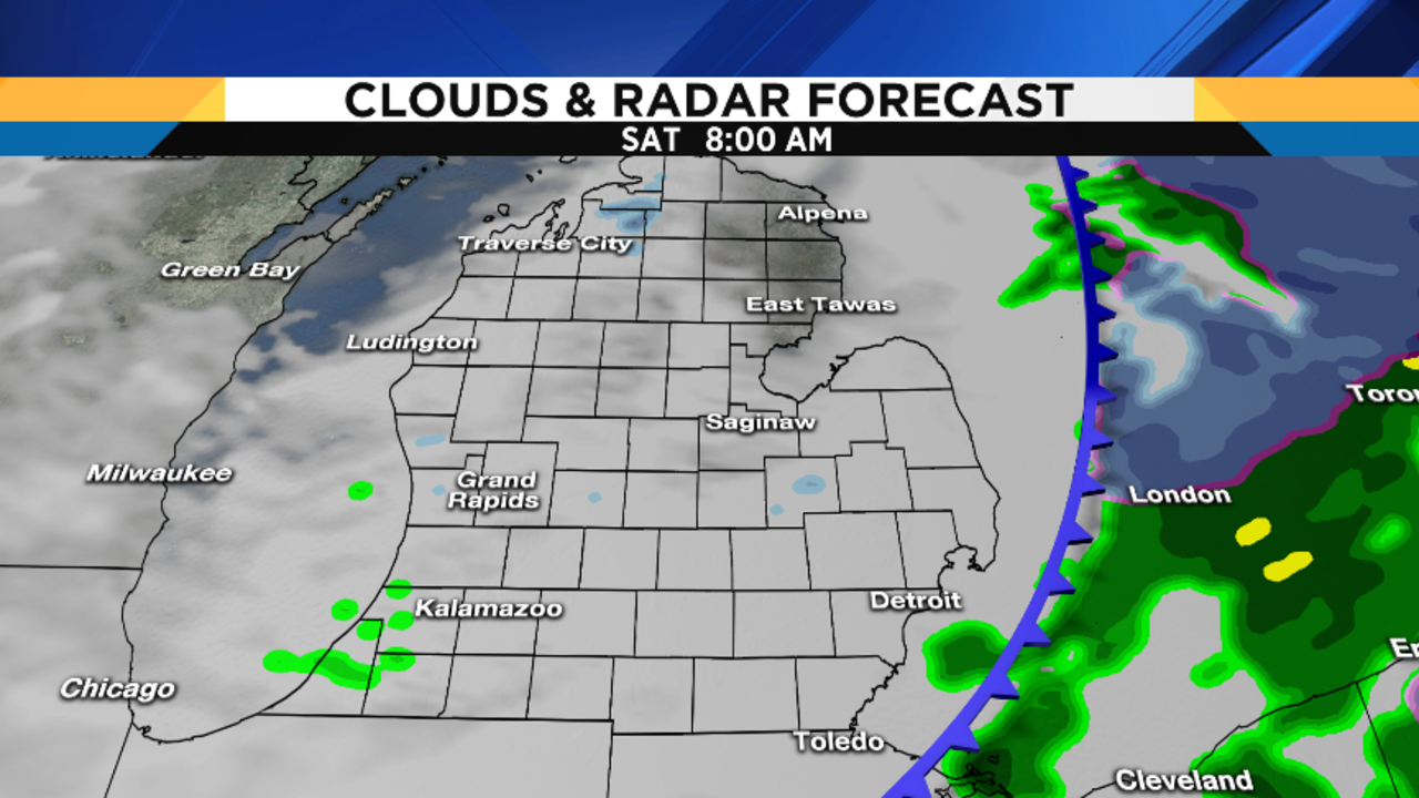
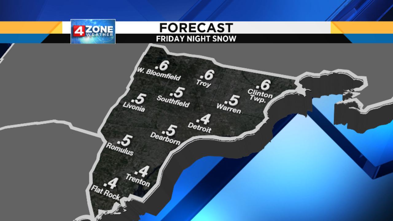
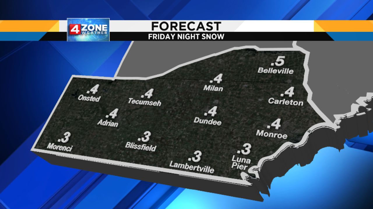
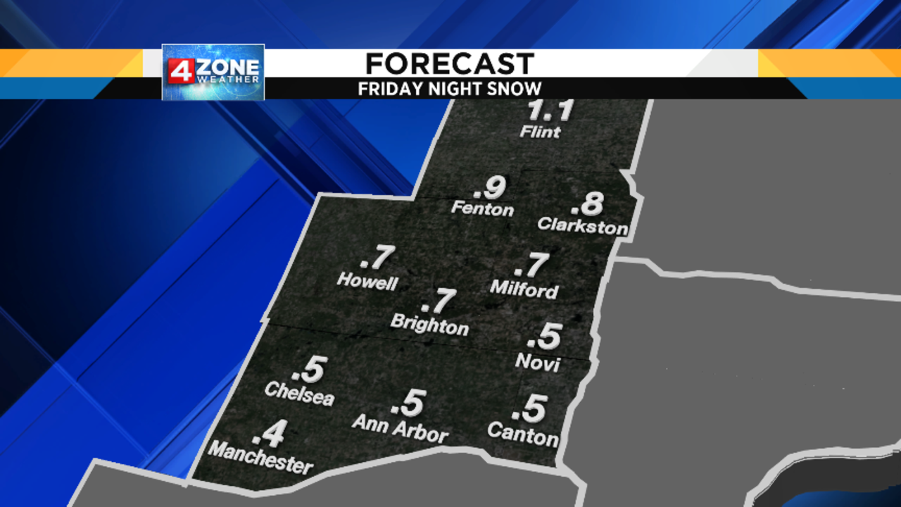
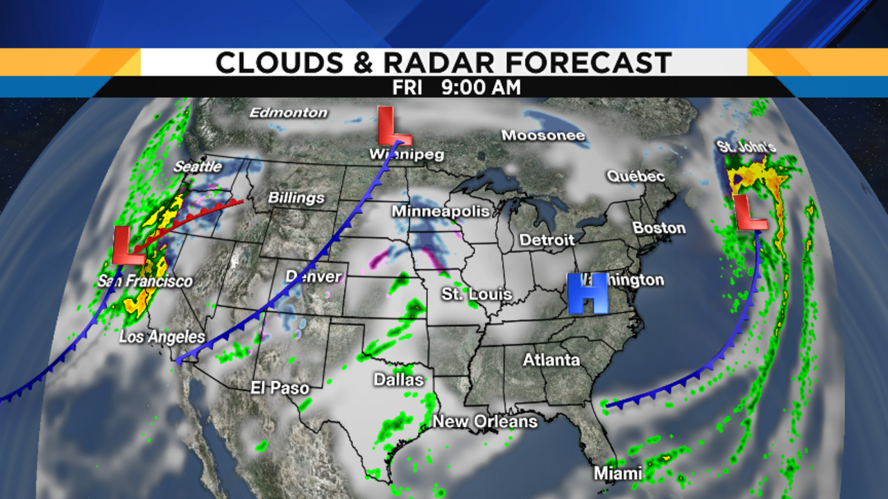
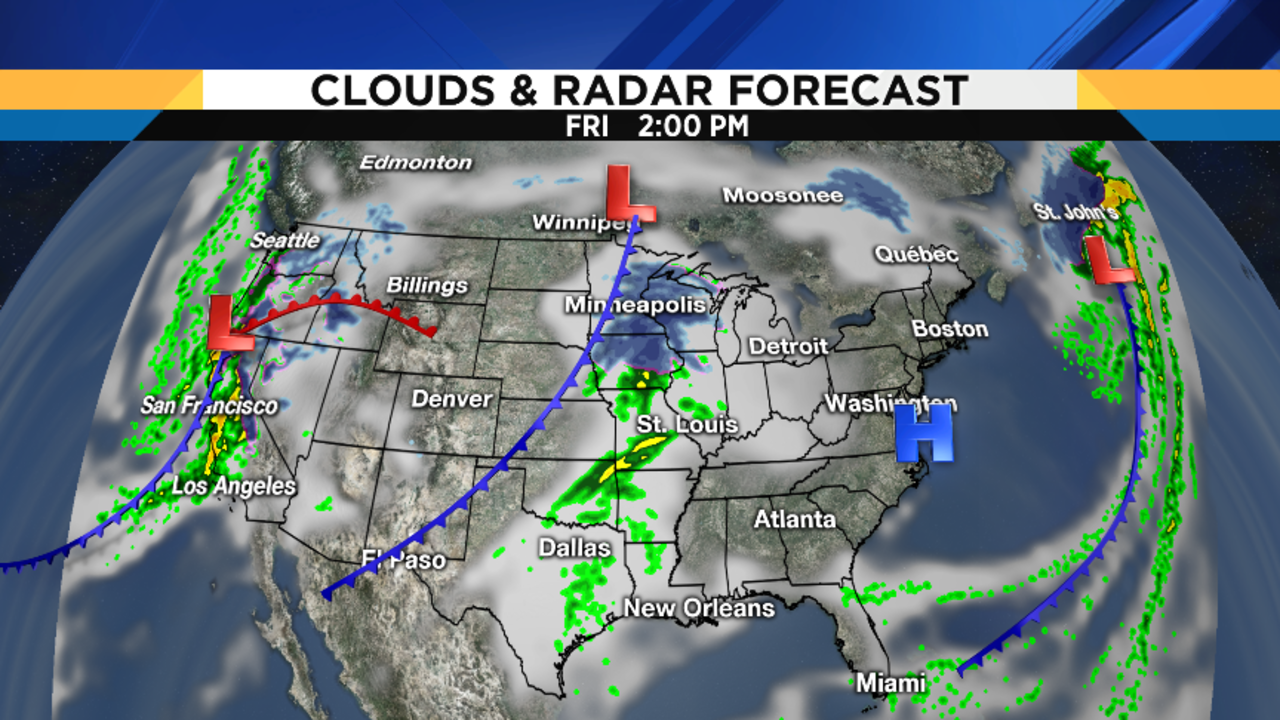
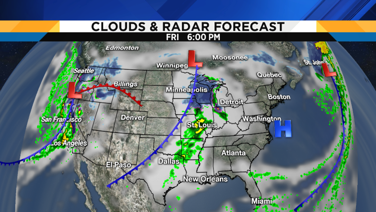
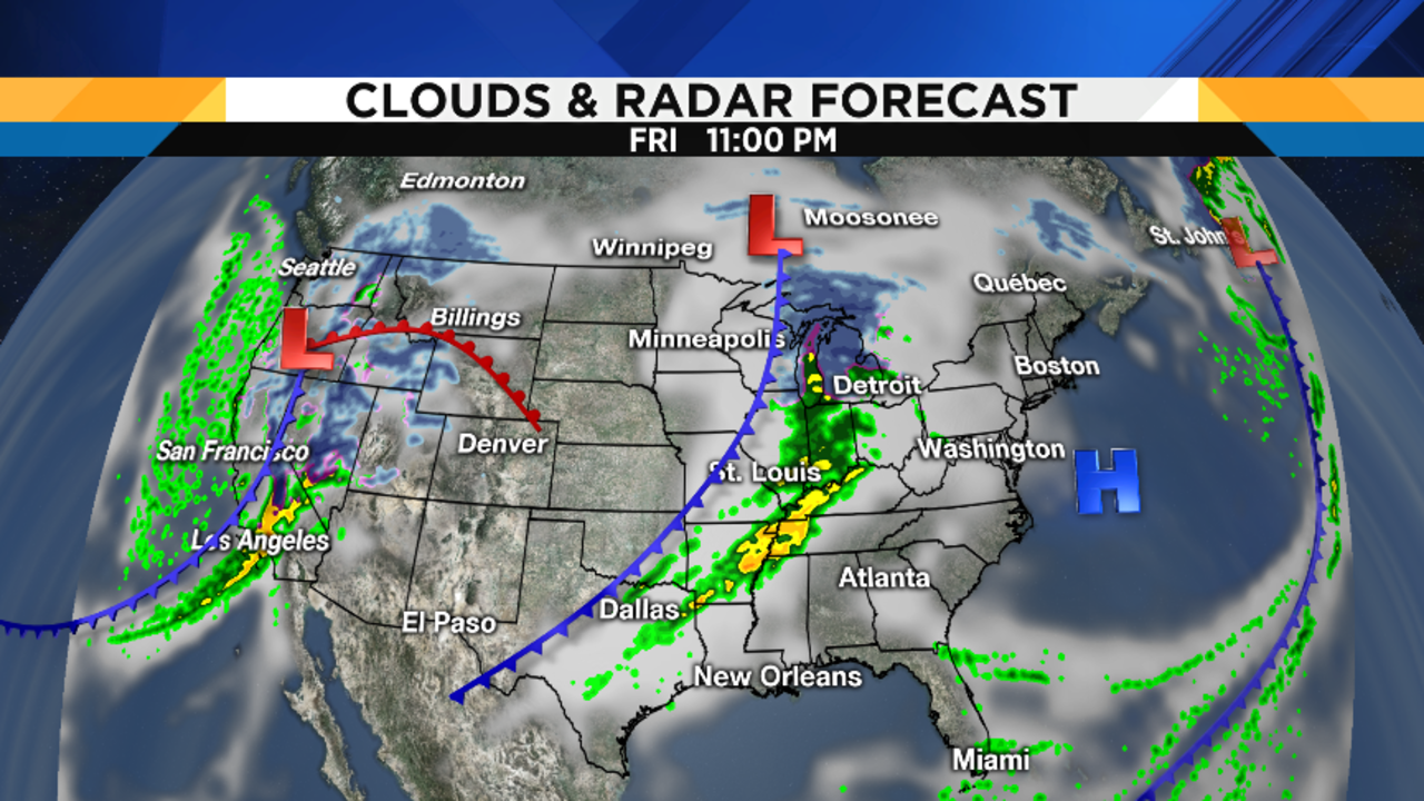
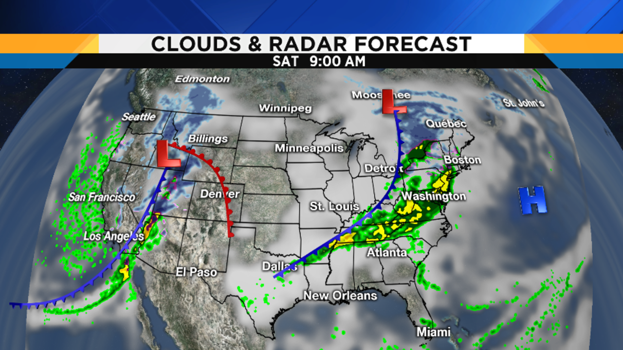
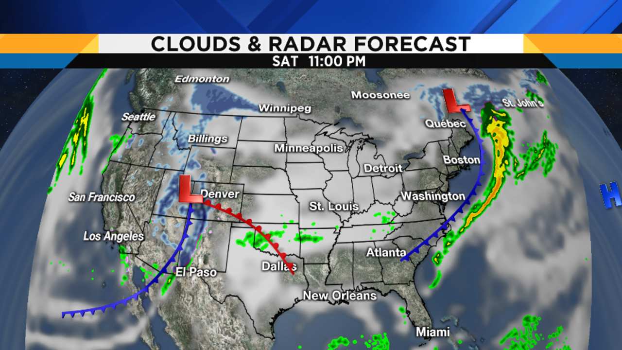
Friday night is really the only somewhat tricky part of the forecast, but the impacts aren’t terribly significant because this particular approaching cold front only has a limited amount of moisture to work with. Rain and snow (possibly with a small band of freezing rain in between if we’re able to cool down enough before the precip arrives) will develop later Friday evening, and be gone by the time we wake up Saturday morning. Obviously, the location of the rain/snow line dictates who gets some accumulating snow, and who doesn’t and, right now, it appears that this line should set up somewhere near or a little north of I-696. Even so, this will be a wet snow and not the fluffy type, so accumulations should remain well under an inch for most of us. Those of you farther north in our North Zone may see enough snow to get a little above an inch. To help you plan, here are some maps showing the timing of things tomorrow evening, as well as my 4ZONE Forecast with the snow amounts I’m expecting right now. Since temperatures will be a little above freezing, salt will work with maximum efficiency on our roads, so I’m not expecting too much trouble coming home from Festivus parties.
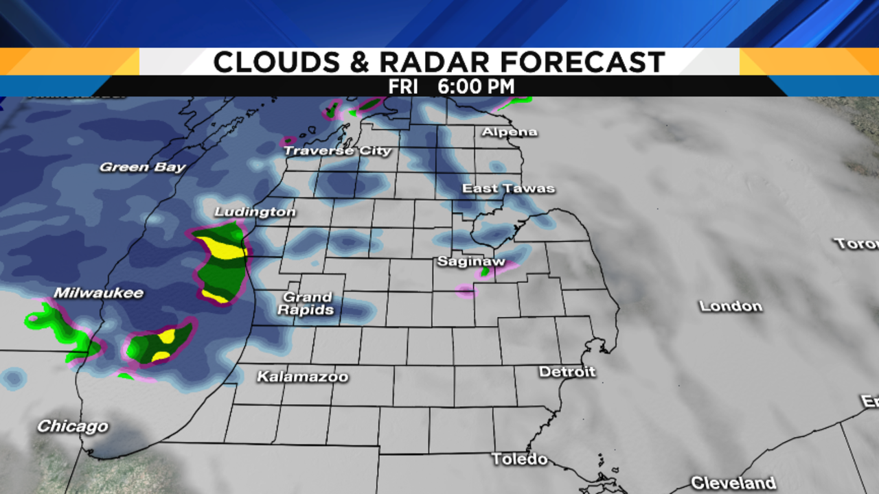
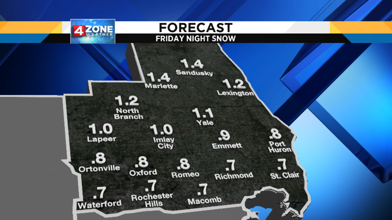
Overnight lows Friday night should drop into the low 30s (0 to -1 degree Celsius), which is close to freezing. My only concern about early Saturday morning is that, if we drop to or below freezing, wet surfaces may freeze and develop ice. Be careful if you’ll be out early on Saturday.
After a cloudy start on Saturday, clouds should start breaking up, and I think we’ll see partly cloudy skies during the afternoon. Highs in the upper 30s (4 degrees Celsius) means that it should be a relatively pleasant afternoon to head to Christmas Eve or Chanukah dinners!
Partly cloudy Saturday night, with lows in the mid 20s (-3 to -4 degrees Celsius).
Any early morning sunshine on Christmas Day will be replaced by increasing clouds. Highs once again in the upper 30s (4 degrees Celsius).
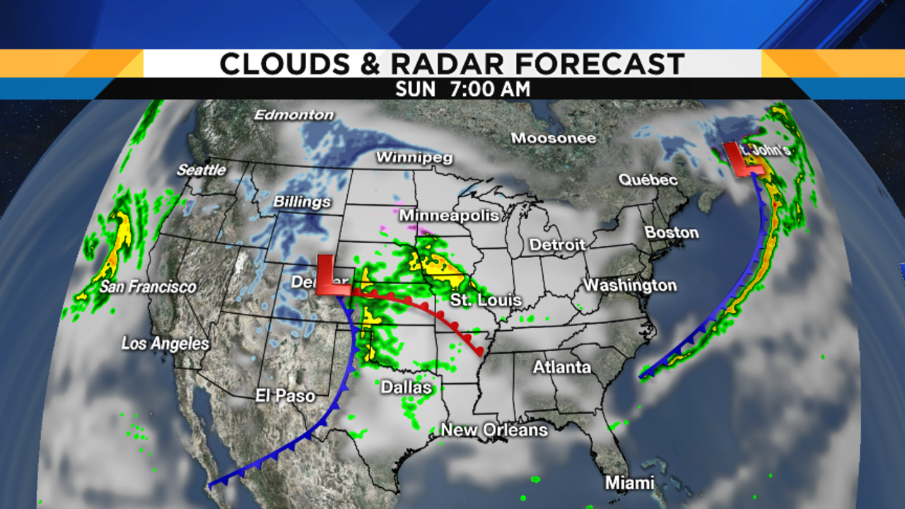
Rain showers will develop Sunday evening and, as long as temperatures stay above freezing, we won’t have any freezing rain to worry about. Don’t forget that the radar display on our Local4Casters weather app is color coded, just like the radar we show you on TV, so you can monitor things on your phone and see if any ice is moving into the area. The app is free…just search the app store under WDIV, and you’ll see it right there. And keep in mind that the app works anywhere in the country (and even in parts of Europe)…you can see the latest radar wherever you are!
Monday is the start of Kwanzaa, and also is our crazy weather day of the week. It’s going to be a mild one, with temperatures in the mid 30s (1 to 2 degrees Celsius) when we wake up – that’s a little above our average HIGH for the day! A strong cold front will cross the area by afternoon, with a band of rain ahead of it. It’ll be a very windy day, too, and those southwest winds will boost temperatures to near 50 degrees (10 degrees Celsius)!
Temperatures drop rapidly behind the front, and Tuesday will be windy and nearly 20 degrees Fahrenheit / 6 degrees Celsius cooler than Monday, with highs in the low 30s (0 degrees Celsius) under mostly cloudy skies. It appears that the rest of the week will feature average wintertime temperatures, so you and the kids will be able to use those new sleds and skis!
Holiday Travel Weather
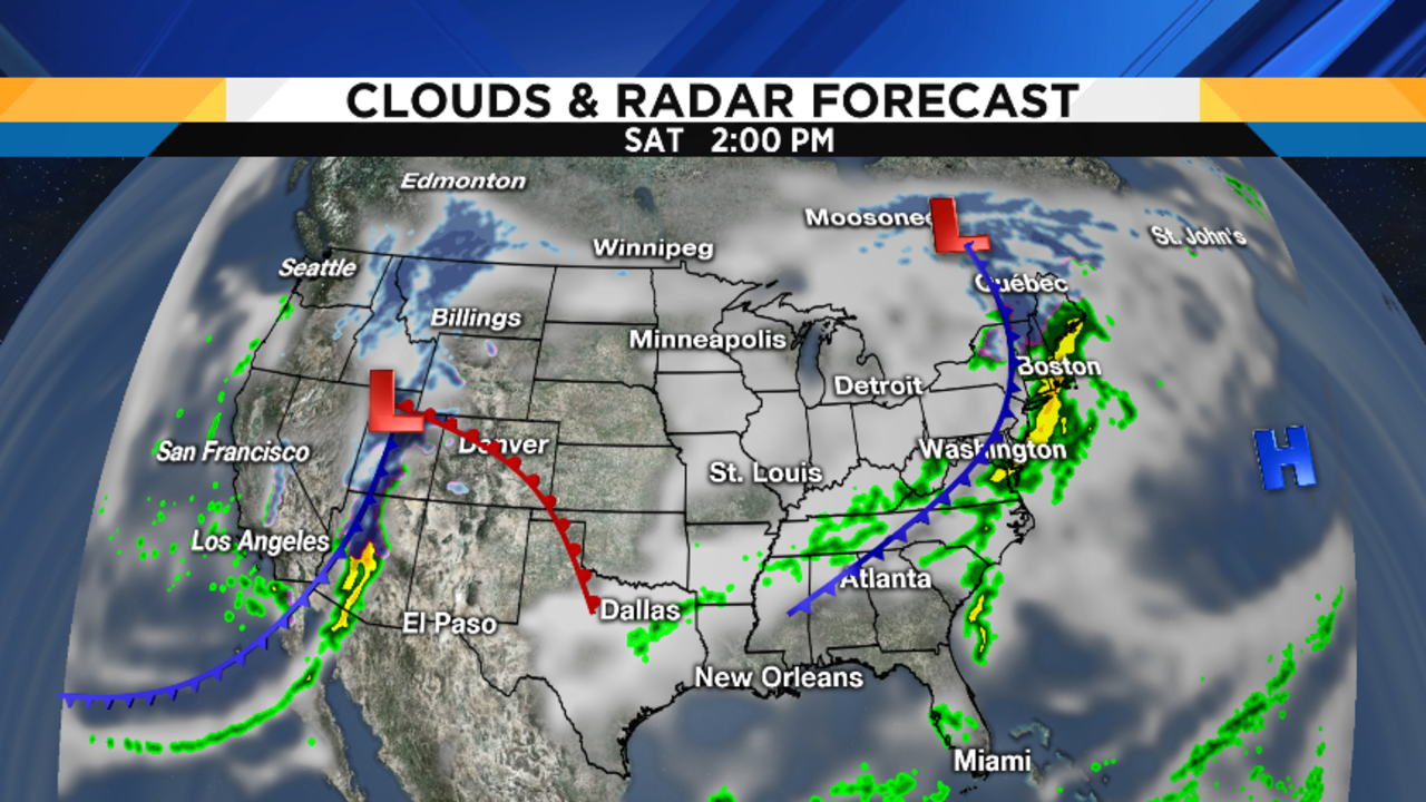
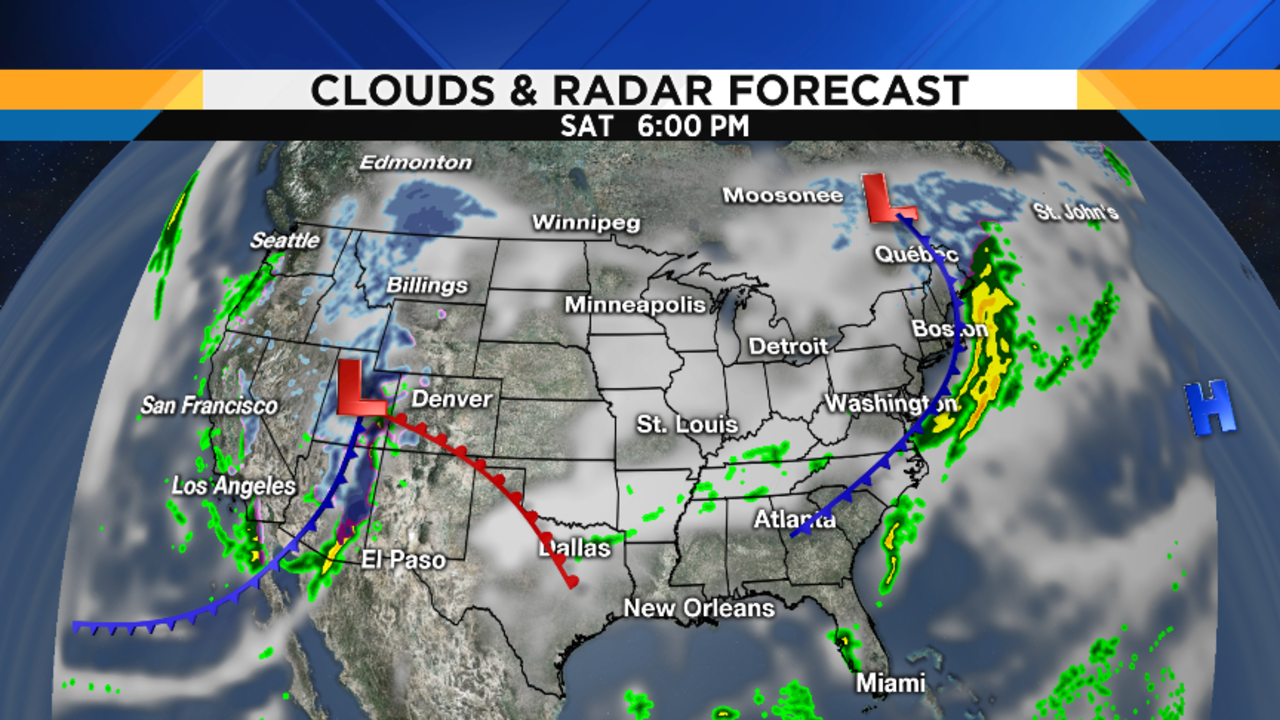
Here are my travel weather maps for the next couple of days. Again, my in-house high resolution RPM model only takes me out 72 hours, so these maps show you what’s going on through 7AM Sunday. The biggest travel headache is just beyond the scope of these maps, and continues to be across the northern Plains Sunday into Monday, as a powerful winter storm takes aim on the region. Here in southeast Michigan, we’ll initially be on the system’s warm side, as evidenced by our balmy Monday temperatures. But farther west, there could be trouble from Minneapolis westward and northward. Minneapolis is a major Delta hub, and there could be some freezing rain Sunday morning before that changes to all rain…but I think the bigger problem will be the flash freeze Sunday night after the storm passes by and sharply colder air rushing in causes moisture on roads to freeze into ice. Aside from Minneapolis, true blizzard conditions will rake northern Minnesota into the western Dakotas and northern North Dakota. You’ll certainly be hearing about this storm on NBC Nightly News this weekend.
These maps should help you (or friends and relatives) travelling before Christmas:
My Wishes To You
Since I’m off tomorrow, I want to take this opportunity to wish you and yours the very Merriest of Christmases and the Happiest of Chanukahs this weekend. While not unprecedented, it’s also not common that Chanukah begins on Christmas Eve. In fact, the last time this happened was in 1978 (Jewish holidays begin at sunset, so I’m talking about Chanukah beginning at sunset on December 24th), and the next one isn’t until 2027. I consider this confluence of holidays to be particularly meaningful. I’ve already had some great conversations with people asking me about Chanukah, and I know many interfaith families who are so excited to have both holidays start on the same night. This occurrence is a wonderful chance for both Jews and Christians to rejoice together in our respective gatherings with families for special times.
Christmas is also a day when Jews and Muslims volunteer wherever possible so that our Christian friends can have the time off to be with their families. In my case, I’m going to take advantage of only my second Christmas off in my 34-year career here at Local 4 to join some members of my synagogue Sunday morning at the Ronald McDonald House, where we’ll be bringing in food and cooking brunch for the families of the children who had to spend Christmas at Children’s Hospital…an annual event for us. This will allow the Ronald McDonald cooking staff to have Christmas morning off.
While there was so much hype and so much to do in the weeks leading up to this weekend, I hope that you now have everything done and can finally relax and enjoy the warmth that the holidays bring. No matter what our faith, we all share the prayer for Peace on Earth and, in this day and age, it truly is needed. May the spirit of the season be with you always. And if you’ll be drinking this weekend, please let somebody else do the driving: I’ll be working for Brandon all next week so he can spend Christmas week with his family, and I would love to see you back here watching…