Although some of the smaller-scale details will not become apparent until I see tomorrow morning’s surface and upper air data, enough appears to be falling into place to raise concern about Friday’s severe weather threat.
First and foremost, you do NOT have to worry about severe weather tonight. Showers and possible thunderstorms should develop around and just after midnight, but these will not be severe. Lows will initially fall into the upper 30s to near 40 degrees (4 to 5 degrees Celsius), but then rise toward morning. North-northeast wind at 5 to 10 mph.
Recommended Videos
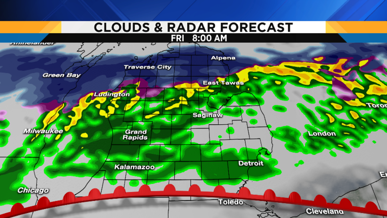
Depending upon the northward speed of the approaching warm front, rain should end from south to north Friday morning (so, those of you in the south will see it end much earlier than those in the north). Some hazy sunshine might even develop. Temperatures will rise quickly as the warm, humid air mass we’ve already seen this week returns to the area, and I expect temperatures south of M-59 to rise into the mid to upper 60s (19 to 20 degrees Celsius). Farther north, your highs may hold in the mid 50s (13 degrees Celsius) in the far north to near 60 degrees (16 degrees Celsius) near I-69.
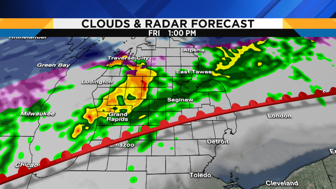
It’s the late afternoon / early evening period that gets interesting (and a little tricky). During the warmest part of the day, but well ahead of the advancing cold front, some scattered showers may pop up. They don’t look very impressive on our computer model above. However, what you see here is not the entire picture. Take a look at this forecast upper air diagram:
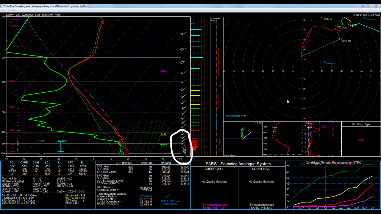
There’s way too much here to even try to explain. However, let me draw your attention to the area I circled…this is projected wind direction and speed as you go aloft from the surface. Notice how, at the bottom (near the surface) the wind is blowing from the south. Then, as you go farther up, the wind is blowing from the southwest. Also note that the wind speed is increasing quickly, too, as you head upward. This sharp change in the wind direction and speed is called wind shear, and what you are seeing (as projected by this one computer model) is very significant wind shear. So, even though we are seeing what appear to be “just” showers on the 6:00 p.m. map above, the tremendous low-level wind shear means that even a routine shower with no lightning could produce a tornado. This is by no means guaranteed – as I mentioned above, there are a number of small-scale details that need to be worked out. But the potential is there, so we need to be prepared.


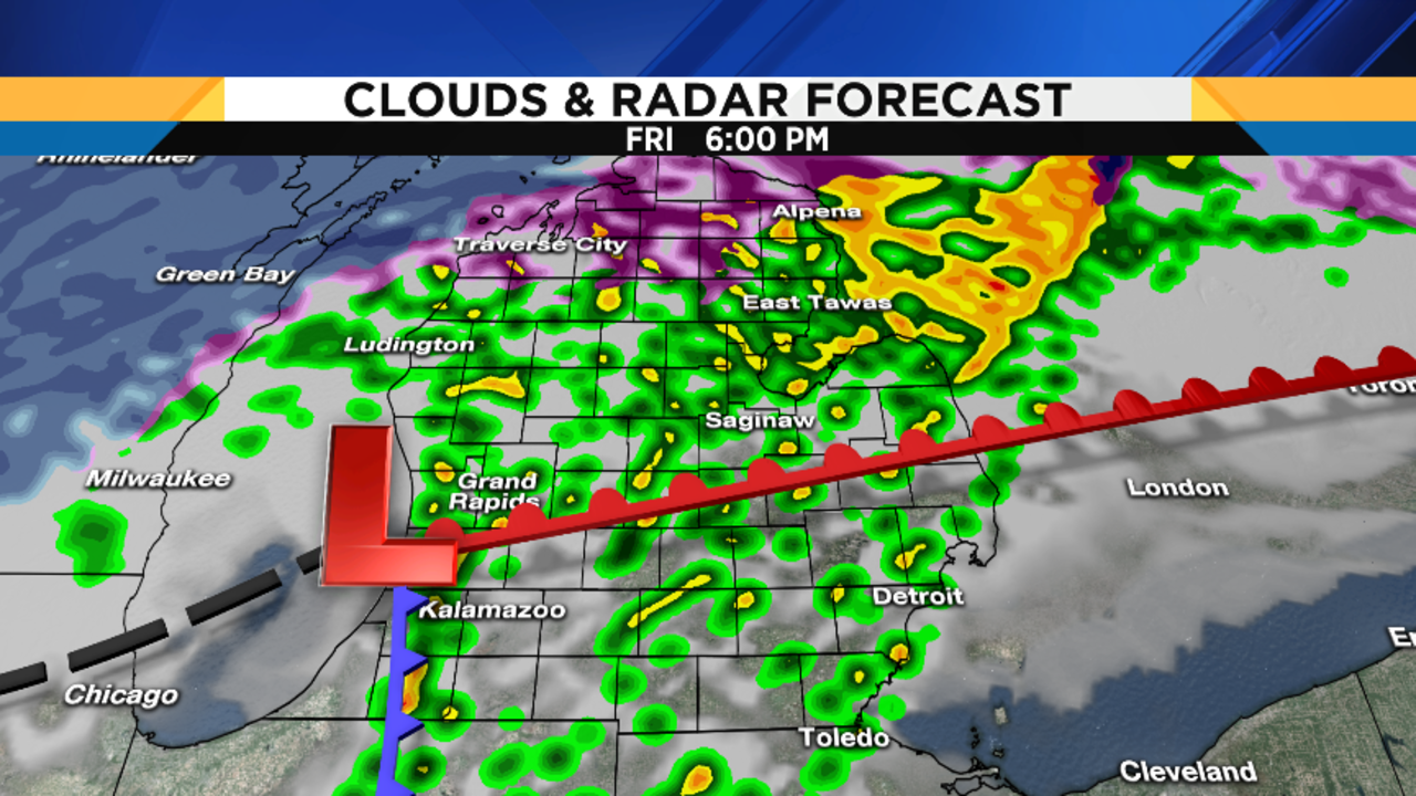
Contrary to what you might think, the tornado threat actually lessens as the cold front gets closer late Friday evening. But I wouldn’t let your guard down. At that point, if we get any storms, the primary threat will be severe straight-line winds, which can also cause a lot of damage.
The second half of Friday night should be mainly dry. Lows will be in the low 40s (6 degrees Celsius).
Temperatures will fall sharply on Saturday, and it’s going to become quite windy. That cold air flowing across the open waters of Lake Michigan (strange to say “open waters” in February, isn’t it?), will generate lake effect snow showers. I don’t expect any meaningful accumulation, but it’ll be a nice reminder that it’s still winter after a week of late-April / early-May weather. Just think “blustery and cold,” and that’ll pretty well sum up our Saturday.
Snow showers will end Saturday night, with lows in the mid 20s (-5 to -4 degrees Celsius).
Partly cloudy and still breezy on Sunday, with highs in the low 40s (5 degrees Celsius).
Briefly, the cold air intrusion will be short…it looks as if we’ll be back to near or even a little above 50 degrees (10 degrees Celsius) by Tuesday or Wednesday…although some rain is on the way, too.