Clouds should gradually break up this afternoon. It’ll be windy today, with highs in the mid teens (-10 degrees Celsius), but a southwest wind increasing to 15 to 25 mph generating wind chills between zero and -10 degrees (-18 to -23 degrees Celsius).
Today’s sunrise was at 8:02 a.m., and today’s sunset is at 5:13 p.m.
Mostly clear tonight, then becoming partly cloudy late at night. Lows around 4 degrees (-16 degrees Celsius). Southwest wind at 10 to 15 mph will generate wind chills of -10 to -20 degrees (-23 to -29 degrees Celsius).
Wednesday forecast
After some breaks of sun to start (particularly in the east), clouds rapidly increase on Wednesday, with some light snow showers developing. This certainly doesn’t look like much…perhaps a dusting at worst. Highs in the upper teens (-8 degrees Celsius).
Partly cloudy Wednesday night, with lows near zero (-18 to -17 degrees Celsius).
Partly cloudy Thursday and Friday, with highs only around 7 degrees (-14 degrees Celsius), and overnight lows ranging from around -7 degrees (-22 degrees Celsius) in our Urban Heat Island closer to Detroit, and between -10 and -20 degrees (-23 to -29 degrees Celsius) in more rural locations. Wind chills these afternoons will average around -10 degrees (-23 degrees Celsius).
IMPORTANT: Wind chill values by early Friday morning (and possibly even Thursday morning) may drop to -15 to -25 degrees (-26 to -32 degrees Celsius), so there potentially could be some school closing issues due to this dangerous cold. The Local4Casters are monitoring closely. Ben Bailey will have the latest later today, and Brandon Roux will update you Wednesday morning.
Mostly sunny on Saturday, with highs around 9 degrees (-13 degrees Celsius).
Partly cloudy Saturday night, with lows near 2 degrees (-17 degrees Celsius).
Becoming cloudy on Sunday, with some light snow potentially developing in the afternoon. Highs in the UPPER 20s!!! That’s -2 degrees Celsius!!! Woo hoo!!! And next Monday, we could even be near freezing (0 degrees Celsius)!!!
A Dubious Record in Jeopardy
Yesterday’s high of 13 degrees (-11 degrees Celsius) was our 7th consecutive day with a high temperature below 20 degrees (-7 degrees Celsius).
Detroit’s record for consecutive days with a high temperature below 20 degrees is eleven. We will easily break that record this week…UNLESS Wednesday’s high (currently expected to be in the upper teens) overachieves and somehow hits 20 degrees.
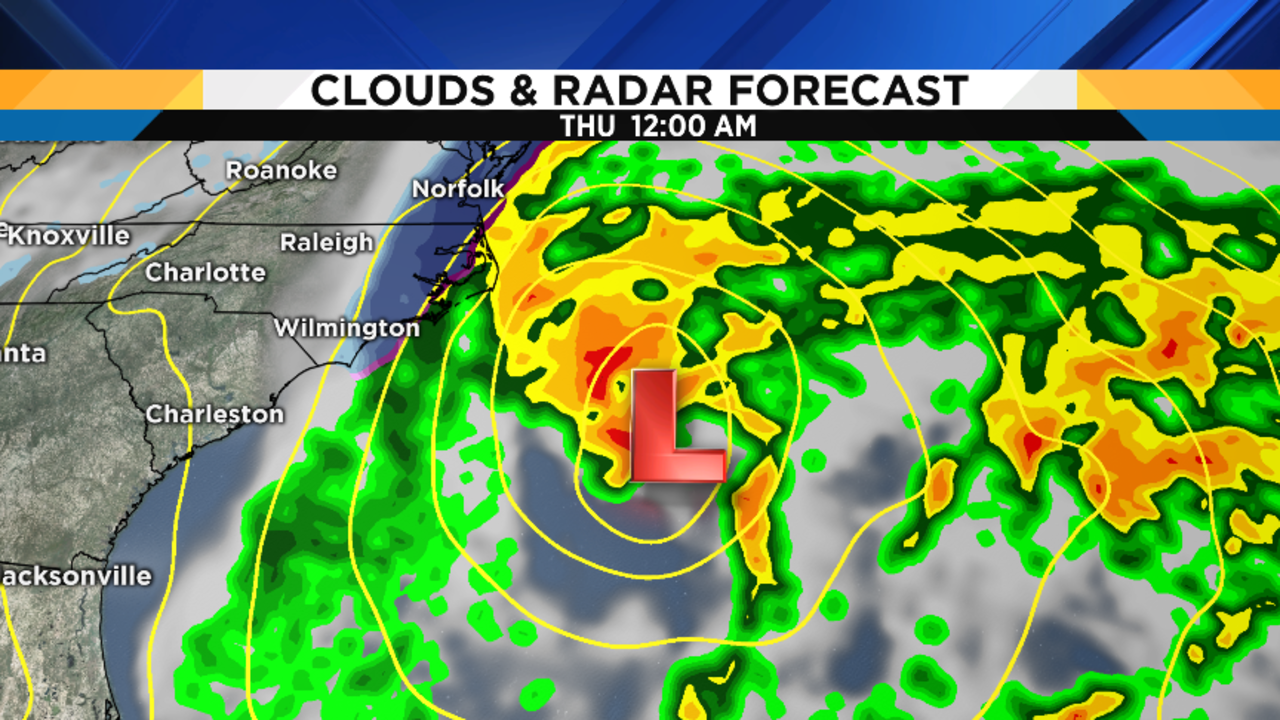
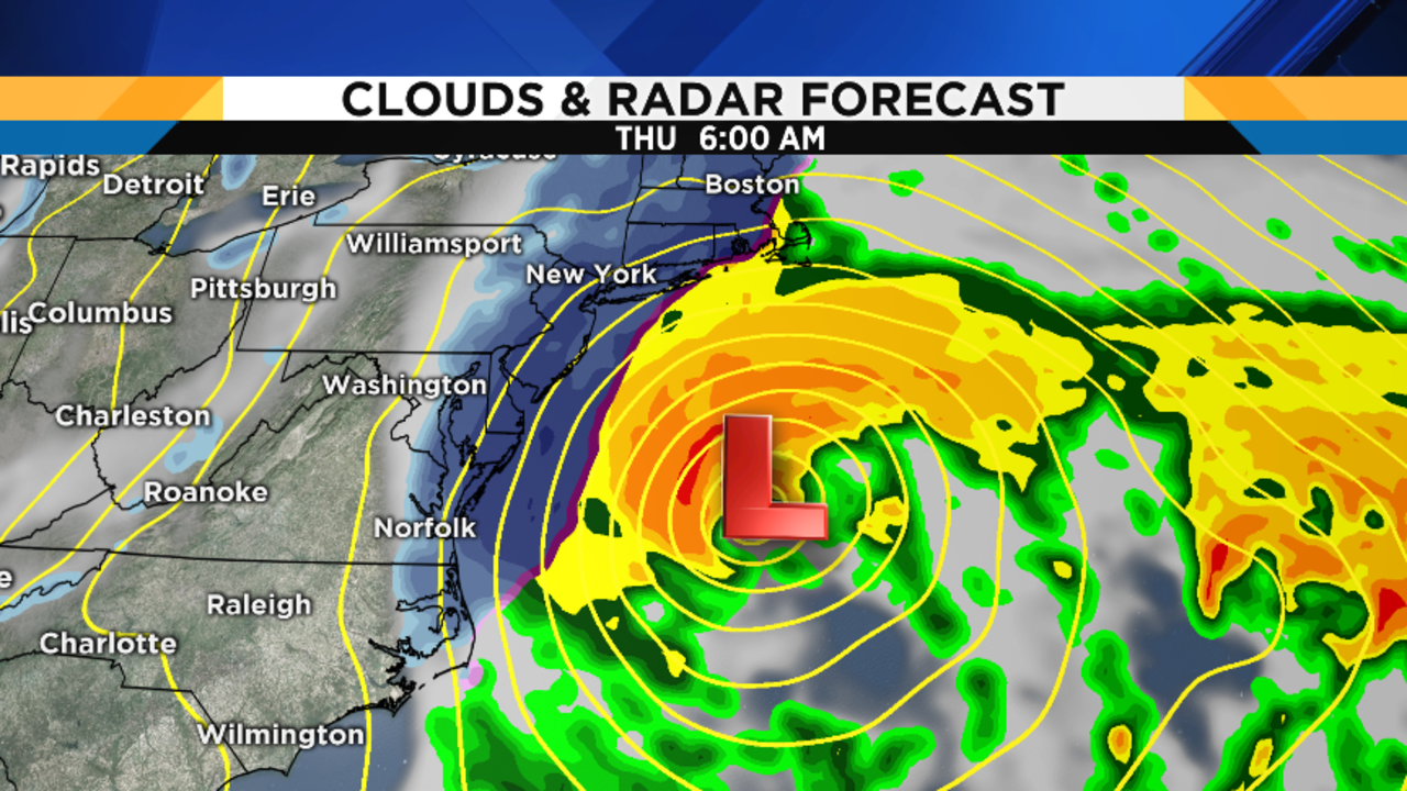
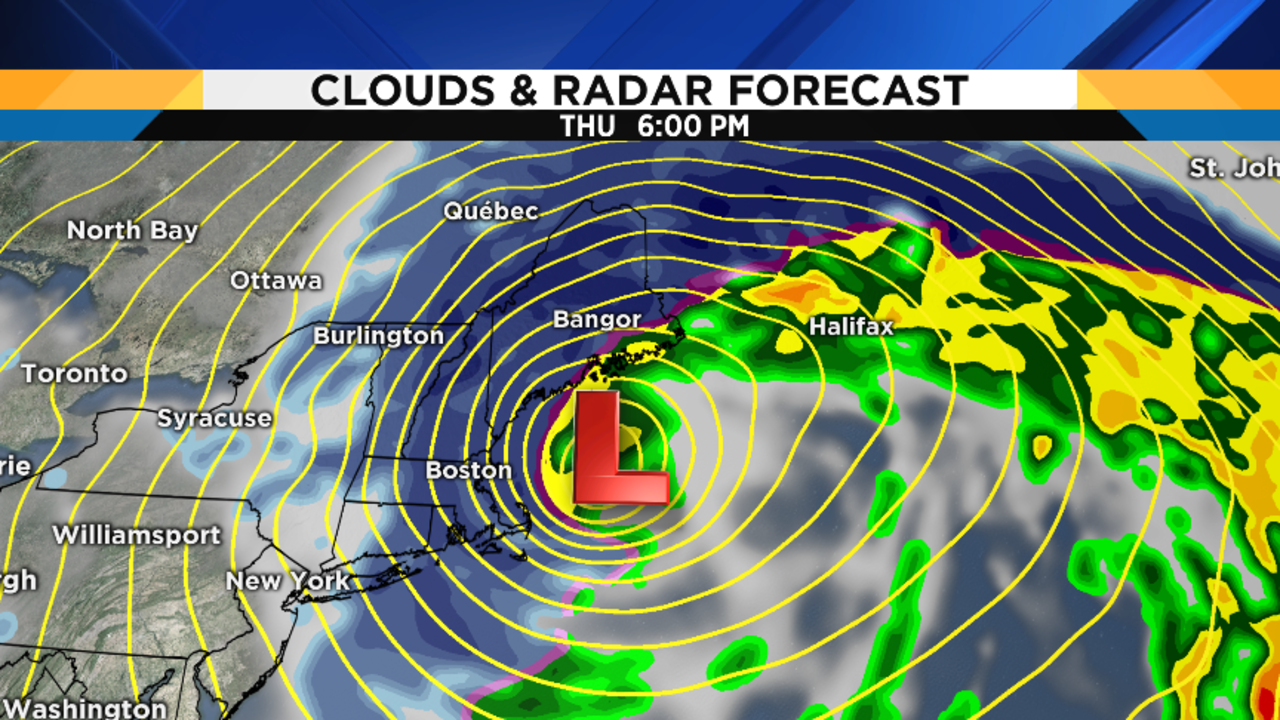
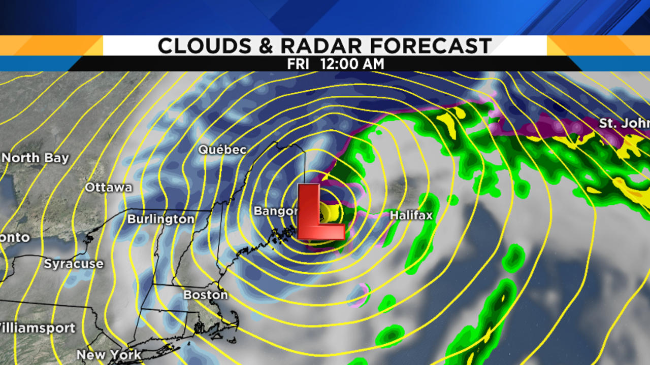
BIG Travel Trouble Out East
In case you haven’t heard, a massive nor’easter storm is going to develop off the southeast coast and move right up the mid-Atlantic seaboard into New England later this week. Thursday, in particular, will be the day with the biggest travel trouble…all of the major hubs from Newark northward will be impacted. If you have travel plans out that way, especially on Thursday, you may need to re-evaluate those plans. Here are some maps to help you plan: