DETROIT – Light rain showers that were headed our way earlier today have pretty much fizzled out -- perhaps a stray sprinkle or very light rain drop is left.
However, the bigger area of rain is just to our west, and those of you in the western part of the viewing area may see some rain this afternoon. The rest of us will (hopefully) get through the afternoon rush hour mainly dry. Highs near 50 degrees (10 degrees Celsius). East-northeast wind will increase to 10-20 mph, and keep those of you on the east side near the big lakes in the 40s (7 degrees Celsius).
Today’s sunset is at 8:04 p.m.
A few showers and sprinkles in the area now but, as expected, main event is tonight/tomorrow. pic.twitter.com/AanjIDVd1C
— Paul Gross (@PGLocal4) April 5, 2017
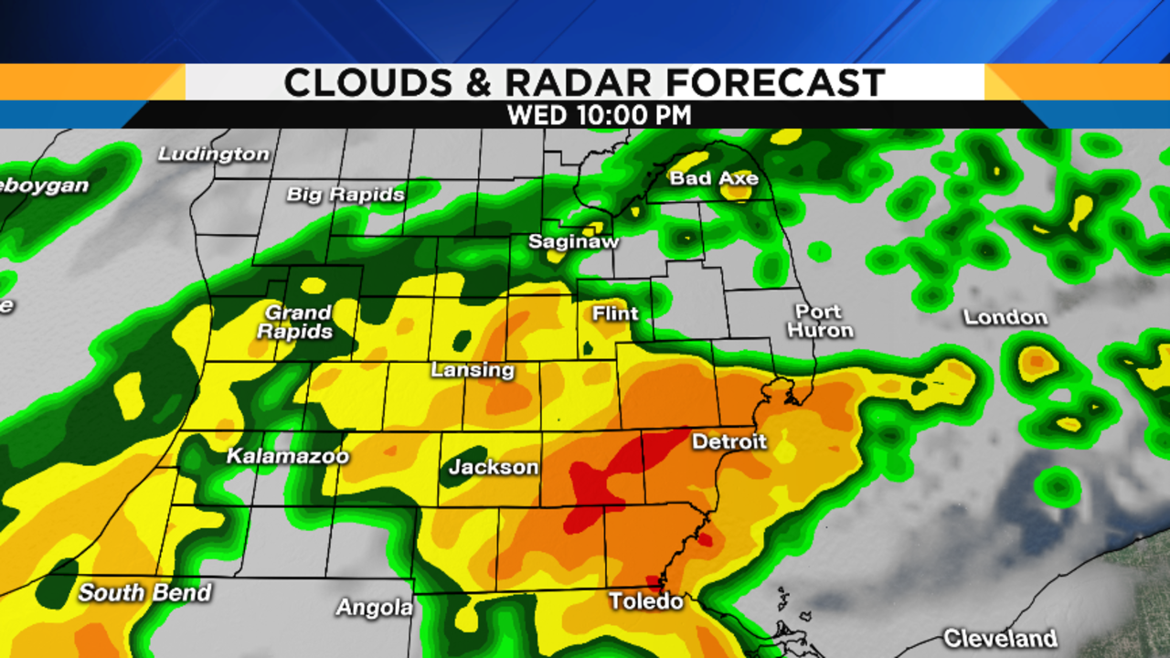
Rain arrives Wednesday night
The long advertised soaking rain arrives tonight, and don’t be surprised if you hear a rumble of thunder…at some point this evening, it’s really going to be raining hard. Lows in the upper 30s to near 40 degrees (4-5 degrees Celsius), and it’s going to start becoming windy.
Here's your storm. Notice the isobars (pressure lines) getting closer together to our south...indicative of stronger wind. pic.twitter.com/p17wbN5wNT
— Paul Gross (@PGLocal4) April 5, 2017
Colder air arrives Thursday
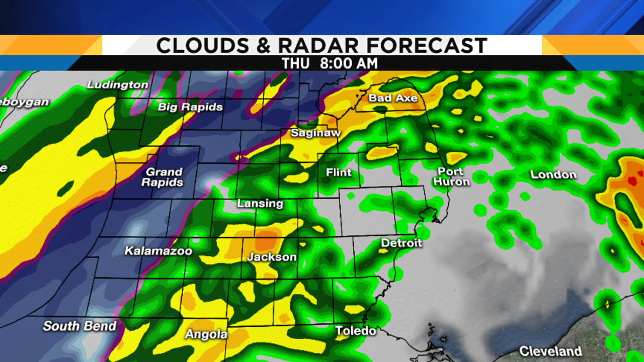
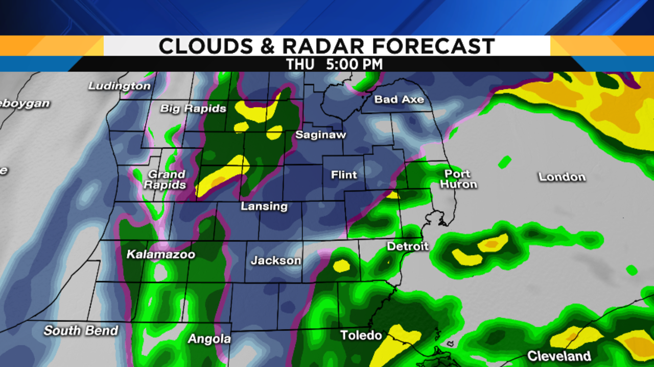
Things start getting interesting as we move through the day on Thursday. It’s going to be a windy, raw, rainy day with highs in the mid 40s (7 degrees Celsius). Total rainfall amounts between 0.75 inches and 1 inch should be easily attainable. However, as the day progresses, colder air wrapping into the back side of the storm system affecting us will change the rain to snow. This process begins across northern and western lower Michigan, with the transition gradually edging eastward.
By the end of the afternoon, some of us north of I-69 and west of US-23 may start seeing some wet snowflakes. If you are driving up north on Thursday, be aware that treacherous driving conditions may develop up that way.
Rain turns to snow Thursday night
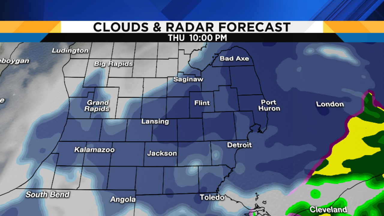
The transition from rain to wet snow will progress eastward Thursday night, with accumulation possible. There are so many factors to consider when trying to predict the amount of accumulation -- things like the thermodynamic profile of the lower atmosphere, air temperature and dewpoint, ground temperature, and lake effect contribution from Lake Huron.
This is an extremely difficult forecast. Based upon the overnight computer models, it would appear that a slushy 1 to 3 inches is possible over the heart of the area, with 4-plus inches possible for our farther northern and northwestern areas. By the way, this will be a very heavy, wet snow -- don’t try to shovel this stuff yourself if you are elderly or have medical problems. Give the kid down the street a few bucks to do it for you -- you’ll thank me later.
One other important factor about Thursday and Thursday night is the increasing wind, which could gust to between 30 and 40 mph in the heart of our area and, due to the smooth waters of Lake Huron (relative to the rougher land surface with trees, terrain and buildings), possibly over 50 mph for the Thumb. This is why the National Weather Service has issued a High Wind Watch for the Thumb from Thursday morning to Friday morning. In addition, they have also issued a Lakeshore Flood Advisory for the Lake Huron shoreline areas, as that strong wind will push the lake water ashore, and possibly cause some flood problems.
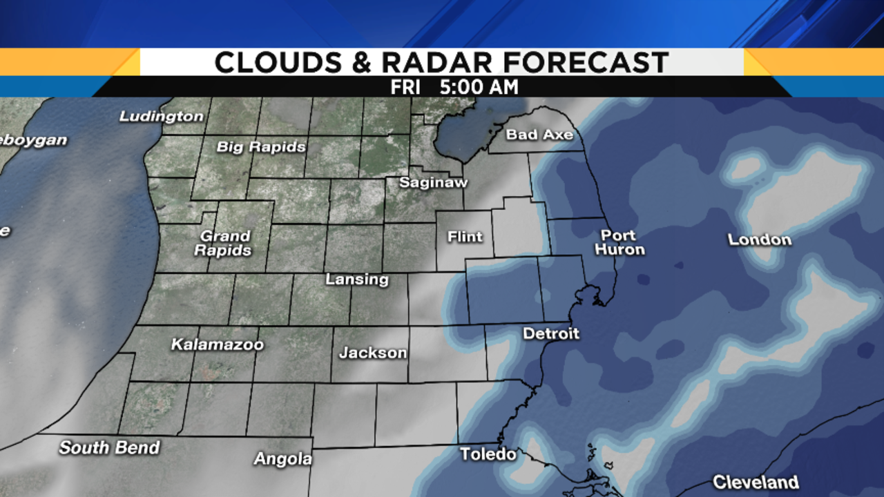
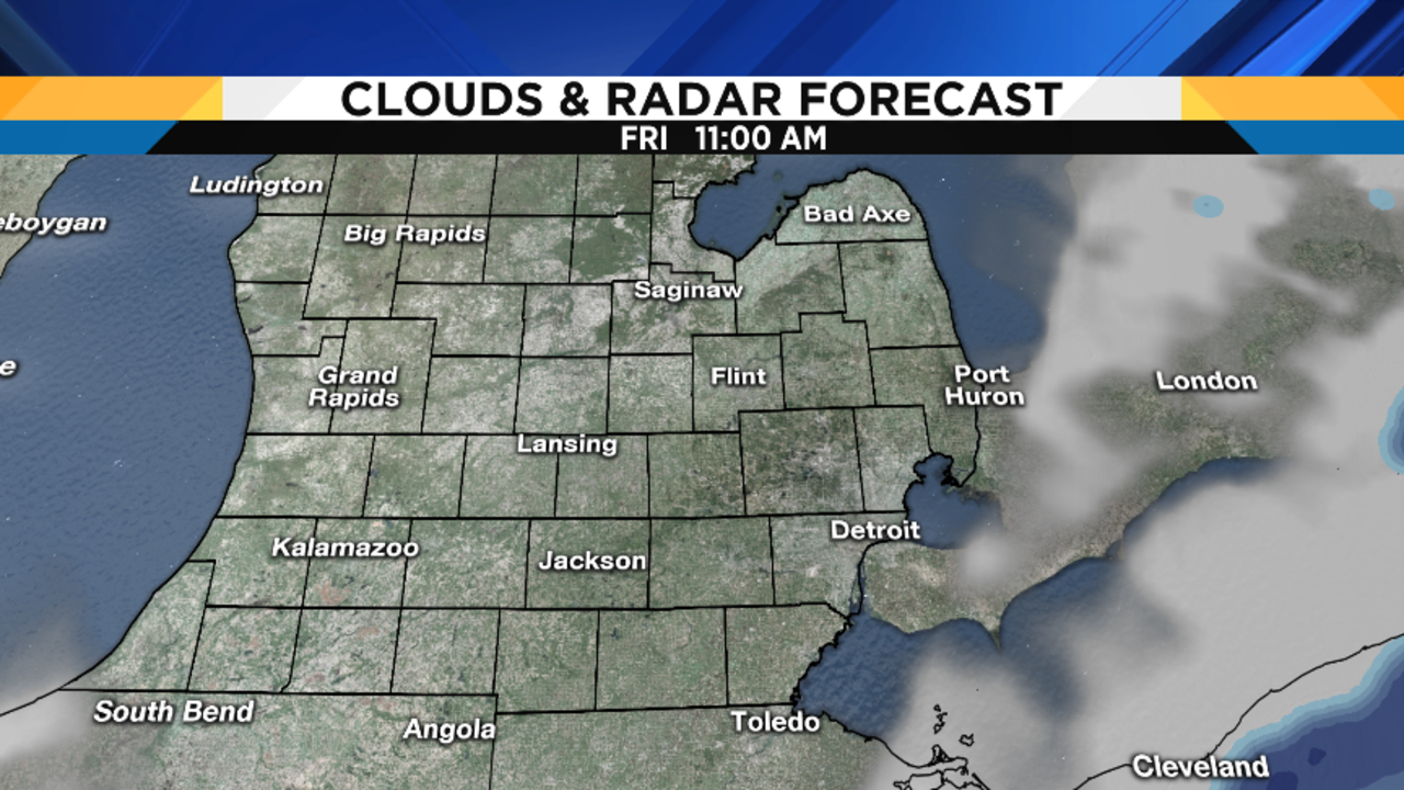
Here’s how the latest run of my in-house RPM model is depicting the weather events of the next forty-eight hours:
Tigers Opening Day forecast
Opening Day is going to be a windy, raw day (so what else is new?). Fortunately, any lingering wet snowflakes should end by 6 a.m., and the game will be dry. In fact, skies will clear and I think we’ll be mostly sunny for the game. However, game temps will only be in the low to mid 40s (6 to 8 degrees Celsius), so you’d better dress warm because wind chills will be in the upper 20s (-2 degrees Celsius). By the way, that strong north wind will be blowing out -- good news for the big bats in the Tigers lineup!
Fortunately, the weekend still looks nice, with plenty of sunshine, and highs Saturday in the mid to upper 50s (14 degrees Celsius), and in the mid 60s (18 degrees Celsius) on Sunday -- although Sunday may become a bit breezy. And temps may hit 70 degrees (21 degrees Celsius) on Monday!
Sign up for ClickOnDetroit breaking news alerts and email newsletters