
A Wind Advisory has been issued for Genesee, Lapeer, Lenawee, Livingston, Macomb, Monroe, Oakland, Sanilac, St. Clair, Washtenaw and Wayne counties until 11 p.m. Saturday.
Yesterday, Mother Nature opened up the heavens and rained out Detroit Tigers Opening Day. Today, she parted the clouds and allowed some sunshine to grace the skies over Comerica Park for a cold, but spectacular-looking Opening Day Take Two.
Recommended Videos
Skies will remain mostly clear overnight, with just some patches of cirrus clouds floating by from time to time. Lows in the low 30s (0 degrees Celsius). Wind will increase from the south at 10 to 20 mph by dawn, with higher gusts.
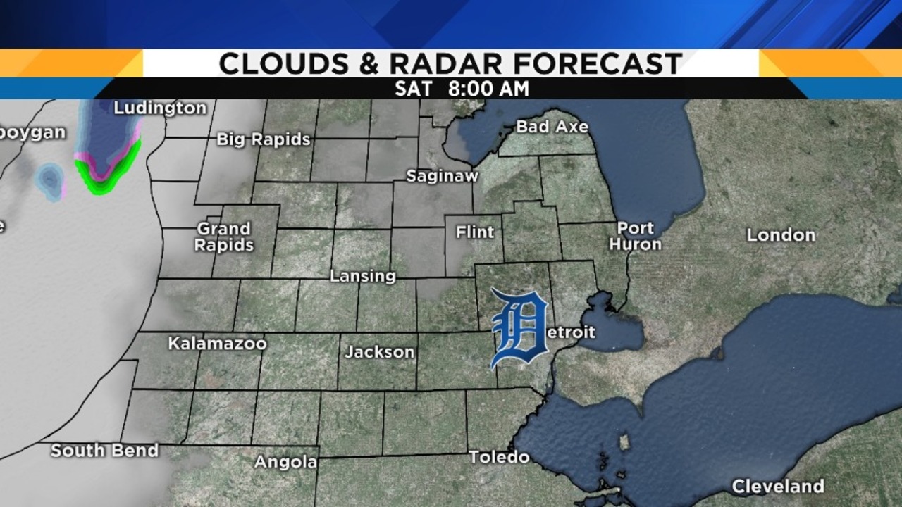
We’ll start our Saturday with some sunshine, but don’t be fooled: clouds will increase, and rain showers will develop by early afternoon. The Tigers’ afternoon game at Comerica Park is a big question mark, depending upon how widespread the rain pattern becomes. Obviously, a game can be played in scattered showers, but not in a steady rain. However, Saturday’s greatest concern is the wind, which will increase steadily through the day. The wind not too far aloft – just 3000 feet or so – will be blowing at 60 to 65 mph, so it will not be hard for rain showers to pull that wind down to the surface, although friction from terrain, trees and buildings do slow it down. As such, widespread wind gusts to or above 40 mph from the south are likely. Of particular concern is a line of showers that will develop just ahead of a cold front crossing the area between 4:00 p.m. and 8:00 p.m. Those showers may be more efficient at tapping into those strong winds aloft. Recognizing the wind threat and potential for downed limbs and power lines, the National Weather Service has issued a Wind Advisory for the entire Local 4 viewing area. Here are some maps to show you the anticipated timing, and keep in mind that the wind gust maps show projected general gusts…individual heavier showers will contain stronger gusts:


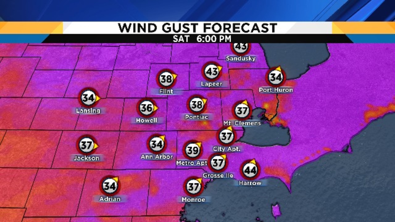


Highs Saturday ahead of the approaching cold front will approach 50 degrees (10 degrees Celsius). The wind will still be strong around the time many people around the area are heading out to Passover Seders or to Michigan Basketball parties…please be very aware of what is happening around you if you’ll be out. The south wind will particularly impact vehicles driving on east-west freeways and roads. The Local4Casters will provide you with the most concise, up-to-date information on Local 4, on ClickOnDetroit.com, on our FREE weather app (just search under WDIV in the app store), and on social media (follow us on Twitter at @Local4Casters and @PGLocal4).
Saturday’s sunrise is at 7:18 a.m., and Saturday’s sunset is at 7:58 p.m.
Partly cloudy Saturday night, with lows in the mid 20s (-4 degrees Celsius). Those of you heading to Easter morning sunrise services will encounter wind chills in the mid teens (-9 degrees Celsius).
Partly cloudy and very cold on Easter Sunday, with highs only in the upper 30s (3 to 4 degrees Celsius). At least those hard boiled Easter eggs hidden on the lawn for the kids to find won’t spoil…Mother Nature will provide natural refrigeration for us.
Mostly clear Sunday night, with lows in the low 20s (-5 degrees Celsius).
Mostly sunny on Monday, with highs in the mid 40s (7 to 8 degrees Celsius).
Rain is likely on Tuesday, with highs near 50 degrees (10 degrees Celsius).
Aside from a possible snow shower Tuesday night into early Wednesday, the rest of the week looks mainly dry at this point, with the below average temperatures continuing.
Some astronomical Easter trivia:
We noticed yesterday that Easter Sunday falls on April Fool’s Day this year, and that got us wondering: when was the last time this happened? The answer is: much longer ago than you’d think. The last Easter to fall on April 1st was in 1956, and the next one won’t be until 2029!
We also wondered: What’s the earliest date that Easter has ever occurred? Easter traditionally falls on the first Sunday after spring’s first full moon (the first full moon after the vernal equinox). Since we celebrated the vernal equinox last week, and we have a full moon tomorrow (Saturday), that makes Sunday as this year’s date for Easter. According to EarthSky.org, the earliest possible Easter Sunday is March 22nd (and the latest possible date is April 25th). Easter Sunday ten years ago was on March 23rd, which made it the earliest Easter of the 21st Century. The next March 23rd Easter Sunday won’t occur until 2160. The last time we had a March 22nd Easter was in 1818, and the next one won’t be until the year 2285. Thanks again to EarthSky.org for the great statistics!
