
DETROIT – As I mentioned yesterday, we really need some rain. Desperately.
While some of us have had a scattered thunderstorm over the past three weeks, many of us have not. Officially at Detroit Metro Airport, we have had only one day of measurable rain dating back to June 6, and that was only 0.24 inches on the 16th. If we include tomorrow (a dry day), that’s just under a quarter-inch of rain in twenty days -- highly unusual around here. Average rainfall over those 20 days is 2.39 inches, so you can see just how severe our rainfall deficit has become.
I pray that we get some downpours Sunday afternoon because, if we don’t get rain then, it’ll be another week before we have a chance of rain. The U.S. Drought Monitor already has us in the “Abnormally Dry” category and, without rain Sunday, some of us may transition into “Moderate Drought” by the end of next week. It’s getting to the point where I almost don’t care if it rains on the weekend -- we need it that bad.
Friday night forecast
Tonight will be a clear night -- great for stargazing -- and very comfortable, with lows near 60° (that’s 15° Celsius for our awesome Canadian neighbors). Any light wind we have this evening will die off and leave us with calm air overnight. This evening’s sunset is at 9:14 p.m.
Saturday forecast
Get ready for a sunny Saturday, great for graduation parties, the Tigers game at Comerica Park, or whatever you have planned. Highs in the mid to upper 80s (30° Celsius). Southeast wind at 4 to 8 mph means that it’ll also be a spectacular day on the water. Because of the abundant sunshine, heat, and light wind, SEMCOG has declared Saturday our fourth Ozone Action Day of the season, as low-level air pollutants will build to unhealthy levels. Believe it or not, there are some very simple things we all can do that actually make a huge difference (they really do):
Saturday’s sunrise is at 5:58 AM, and Saturday’s sunset is at 9:14 PM.
Mostly clear Saturday night, with lows in the mid 60s (18° Celsius).
Sunday forecast
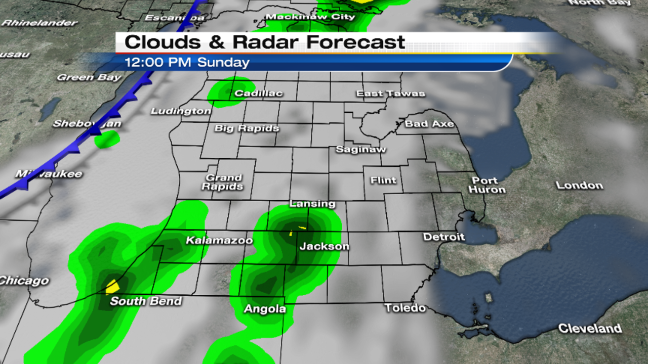
Mostly sunny to start on Sunday, then clouds will increase by midday. Thunderstorms are possible Sunday afternoon, especially by late afternoon into the evening. As I discussed yesterday, there are positives and negatives in the atmospheric ingredients as to whether or not we have a chance of severe storms. Positives include a warm, humid airmass and a cold front approaching during the hottest part of the day. It’ll be very unstable in the lowest two miles above the surface, but then comes our negative: above that unstable lower level, it becomes much more stable.
This is a similar situation that we’ve had on some other days this spring and early summer, and that mid-level stable layer (called a “cap”, because it puts a lid on the rising air parcels we need to generate thunderstorms) on those days sure squashed a lot of our thunderstorm activity. The strength of that cap won’t be apparent until we see Sunday morning’s upper air data, so the best I can tell you right now is to be aware of the afternoon thunderstorm potential and, if you have outdoor plans, check the radar often on our free weather app. I’ll also tweet storm updates if the need arises so, if you haven’t already, follow me on Twitter at @PGLocal4.
Here are some maps with preliminary timing thoughts for the Sunday weather.

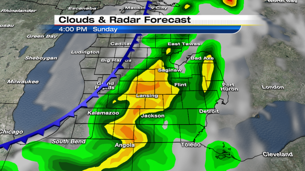


Sunday’s high will be near 90° (32° Celsius), and it’s going to be a humid day. Any evening thunderstorms will end by late evening, with skies becoming partly cloudy -- but it’s still going to be a warm night, with lows only in the upper 60s (20° Celsius).
Partly cloudy on Monday -- a hot but dry day for the Ford Fireworks! Highs in the upper 80s (31° Celsius).
Mostly clear Monday night, with lows in the mid to upper 50s (14° Celsius).
Partly cloudy on much cooler on Tuesday, with highs in the mid 70s (24° Celsius).
Mostly clear Tuesday night, with lows in the mid 50s (12° Celsius).
Mostly sunny both Wednesday and Thursday, with highs in the upper 70s to near 80° (26-27° Celsius).
The long range maps suggest a continuation of our dry pattern right through next weekend.