
4Warn Weather – Metro Detroit will keep a chance for isolated showers through Tuesday evening before skies gradually clear overnight, setting the stage for a quieter Wednesday.
Areas of fog could develop overnight as winds become light and skies begin to clear, especially in locations that received rain. Lows will generally fall into the mid-60s.
Wednesday brings a break for most of Metro Detroit
Patchy fog is possible early Wednesday before partly sunny skies take over. Most of Metro Detroit should stay dry, with afternoon highs generally reaching the lower to middle 80s.
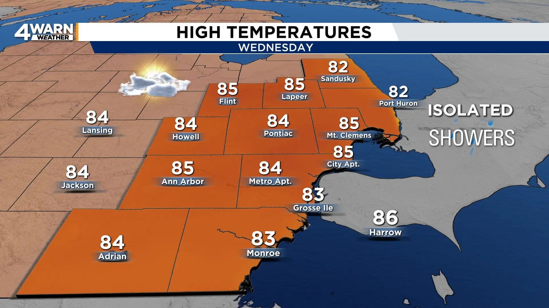
There is still a chance for isolated thunderstorms Wednesday afternoon and evening, but the better opportunity appears to be farther north, particularly toward the Saginaw Valley and Thumb.
The National Weather Service says any stronger storms that develop in that area could produce hail, strong winds and downpours.
Wednesday night should be partly cloudy and comfortable, with temperatures dropping into the lower to mid-60s.
Another shower chance Thursday
Another disturbance could bring scattered showers back to parts of Metro Detroit Thursday afternoon.
Rain coverage is expected to remain limited, which means most locations may stay dry.
Highs Thursday will generally range from around 80 to the mid-80s.
Any showers should diminish Thursday evening as a cooler and drier air mass begins moving into the Great Lakes.
Friday and most of Saturday look like the picks of the week
High pressure takes control Friday, bringing mostly sunny skies, lower humidity and highs from the upper 70s to lower 80s.
Friday night could turn noticeably cooler, with some communities dropping into the 50s.
Saturday could shape up as a nice weather day for the Woodward Dream Cruise in Oakland County.
It looks largely dry and pleasant, but a couple of stray showers are possible.
Otherwise, expect a mixture of sunshine and clouds with highs mainly in the upper 70s to around 80 degrees.
Storms and heavier rain could return Saturday night into Sunday
The next weather system is expected to approach the Great Lakes late Saturday.
Showers could begin developing Saturday night, followed by a better chance for showers and thunderstorms Sunday.
There are also early indications that the system could carry enough moisture for locally heavy rainfall.
The information supports rainfall totals greater than an inch in some parts of the region, although it is too early to determine exactly where the heaviest rain would fall.
Sunday will be warmer and more humid, with highs generally reaching the lower to mid-80s.
Drier weather is expected to return Monday, with partly to mostly sunny skies to partly cloudy and highs around 80 to the lower 80s.
Share your weather photos with Local 4 at MIPics.
