

Metro Detroit gets another dose of pleasant early fall weather for the rest of the weekend, although some early risers may encounter fog before the sunshine takes over Sunday.
Saturday night will remain mostly clear and cool across Southeast Michigan. Temperatures will fall into the mid-40s and lower 50s in many communities, with Detroit remaining around 50 degrees.
Patchy fog could develop late Saturday night into early Sunday morning. The better opportunity appears to be across northern portions of Southeast Michigan, especially toward the Thumb and areas closer to Lake Huron.
Drivers heading out early Sunday should be prepared for locally reduced visibility, but the fog should not last long.
Great weather for Lions tailgating
The weather should cooperate nicely with Lions fans heading downtown Sunday.
The Detroit Lions host the New York Jets at Ford Field with kickoff scheduled for 1 p.m.
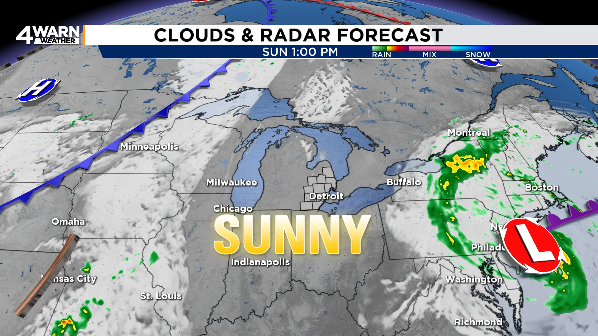
Early tailgaters may want a sweatshirt or light jacket, especially during the first few hours of the morning when temperatures are still in the 50s and lower 60s. Any patchy fog should quickly dissipate, followed by plenty of sunshine.
Temperatures should climb into the upper 60s by late morning and reach the lower 70s during the afternoon. North to northeast winds around 5 to 10 mph will add a light breeze.
That means sunglasses should be useful, while umbrellas can stay at home.
Dry weather sticks around
The pleasant pattern does not end with the weekend.
Monday should begin with another opportunity for patchy fog before sunshine becomes dominant. High temperatures will again reach the lower to mid-70s.
Tuesday looks very similar, with some early fog followed by sunshine and highs around the mid-70s.
High pressure over the Great Lakes is helping to keep Southeast Michigan dry, but that pattern is expected to gradually break down Tuesday night into Wednesday.
That will open the door for increasing clouds and shower chances Wednesday. Rain chances remain in the forecast Thursday and Friday. A stray shower will be possible Saturday.
Powerful nor’easter hits New England
While Michigan enjoys quiet weather, the story is dramatically different farther east.
A strong and long-duration nor’easter is affecting parts of the Northeast and New England this weekend, bringing heavy rain, powerful winds, coastal flooding and beach erosion.
The National Weather Service in Boston says damaging wind gusts and power outages are concerns.
High Wind Warnings cover portions of Massachusetts and Rhode Island. Northeast winds of 20 to 30 mph with gusts as high as 60 mph are possible through early Sunday.
Several inches of rain are also possible in southern New England, while persistent onshore winds are driving rough surf and coastal flooding.
The storm is expected to remain a problem for parts of New England into Sunday and, in some areas, into Monday before conditions gradually improve.
Back in Southeast Michigan, sunshine, mild temperatures and largely dry weather will dominate through the first half of the week.
Share your weather photos with Local 4 at MIPics.
